What WILL you make with a GPS enabled or very detailed track editor?

  • Thread starter smskeeter23
  • 1,100 comments
  • 105,340 views
Ok to try this again I whipped up a crude example of what I was talking about...

I plotted this map of Road America (Circuit and Kart layout) using http://www.gpsvisualizer.com/draw/ and placed some random points to try to illustrate how GPS records data (this is the red line). Again there are so many variables in GPS tracking resolution, accuracy, and presented sample that I could only create a "sort of" reference.

The yellow line represents what a possible, theorhetical, smoothing algorithym in the game might do. Again this is only for demonstration purposes of a possibility.

As you can see since there would be more datapoints collected over the course of a full size racetrack the results would be more accurate than when you try to recreate smaller detail like the Karting track.

Untitled-2.jpg


Now, if you were to slow down you would obviously collect more data points and have a much more accurate model. However, what happens if there is a cap on captured datapoints? This...

Untitled-3.jpg


I must say that I am still very excited because even if we can't recreate what we want exactly there will still be an endless stream of great tracks being made.

The point is though that we still don't know and honestly I don't really expect to for some time yet but the stuff in this thread is great and any coming limitations in the software shouldn't deter us from dreaming up what we would map if/when we can 💡
 
I've been there, about 2 hours north of me, well not the actual event (I was born exactly 44 years after the second date) but went around where it was held, pretty awesome
Nifty.
Mountain roads here are steep, eh?

I've seen some photos of vintage cars from those races & it looked pretty cool.

It's about 1/2 hour south of me, but I used to live in Wilkes-Barre in my youth, and spent some time at the scenic lookout area (popular hangout). I recall some friends wouldn't take their cars up the hill because they were worried about the strain on their engines - it's that steep.

Lots of squirrelly winding twisty roads here in Northeast PA.
Including my work commute over the summer (24 miles / 45 min). A portion of that commute is the route to my family's cottage, which takes me from the city I live in, up a steep hill, over a mountain, and down into the Susquehanna River valley.

I don't think the course creator will allow a 20 mile spread though?
So it would be hard to duplicate lengthy commutes.

One up side... at least in the game, the road surface has a pretty good shot of being in decent condition compared to the roads in Pennsylvania. :crazy:

Going to go toy with that GPS visualizer someone posted. :D thanks.
 
I don't want to wreck the hype train, but do you guys have any real experience with GPS logging? I logging my MTB rides (and uploading to strava.com) and from my experience GPS accuracy can be quite off.
I don't think that good track can be created from raw logged GPS data, it will need some editing to get shape of the corners right. Maybe draw track in Google Maps and export GPS data will be more straightforward, even though I don't know if that is possible.

I've used Endomondo to track jogging and I found that results can vary. Usually I got very accurate results showing right down to the side of the street I was on - it overlays your path on Google Maps. Occasionally it would mess up rather noticeably and always in the same section of my route. It also records elevation and can play that information all back on a graph in combination with retracing the route on the map. I believe we will be able to record fairly accurately although it may take several tries, require going as slow as possible, and of course it wouldn't hurt to bribe some satellites to give us good readings. ;)

Edit: I realize we don't know if elevation will be included in the GT app, but my point simply is that an app can do it.
 
Last edited:
Im going to take the new NISMO GTR to VIR (Virginia International Raceway) this summer then recreate the track in game and use the downloadable telemetry feature
 
I've used Endomondo to track jogging and I found that results can vary. Usually I got very accurate results showing right down to the side of the street I was on - it overlays your path on Google Maps. Occasionally it would mess up rather noticeably and always in the same section of my route. It also records elevation and can play that information all back on a graph in combination with retracing the route on the map. I believe we will be able to record fairly accurately although it may take several tries, require going as slow as possible, and of course it wouldn't hurt to bribe some satellites to give us good readings. ;)

Edit: I realize we don't know if elevation will be included in the GT app, but my point simply is that an app can do it.
Elevation is notoriously inaccurate on most phone gps systems. Usually these apps have to cross compare to real map data once you have uploaded it to the server.

I don't expect much elevation wise when this gps track generator finally sees the light of day...
 
Really only two options here I would have thought.

The app uploads the GPS trace to your online PSN account, which the game then download off the server.

Or

You transfer the file from your phone via either USB or other method to your local PS3.

Given the messy nature of the second option, my guess is the first option.

What about Bluetooth?
 
If the editor works well enough, and if I get time, I will work on many of the wonderful tracks from GT4 which were left out. But I expect many others will be trying to do the same thing...
 
I didn't know that GT6 will only work with GT app, that is quite bad. Support for standard gpx or kml files would be much better as gpsvisualizer.com can save in those formats and layout of the track will be 100% accurate.

Well that's another thing we're still not sure of. I presume that's how it will be but we don't yet know for sure.

I agree that it sure would be nice to be able to upload our own raw data.
 
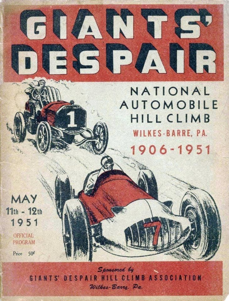
Hmmm. I might like to see Giants' Despair...
c48efd44ff59d67cf40acc0c1adb5de7.jpg


Well, at least I hope people make stuff like that and aren't just driving around their suburban sprawl subdivisions.
...and the Reading Hillclimbs and Weatherly hillclimbs and Polish Mountain Hillclimbs and, well, all the hillclimbs i can think of!
 
Pittsburgh Pennsylvania is a city that has never received the racing love I feel it deserves. Beautiful scenery, tunnels, bridges, interesting road layouts, tons of change in elevation, stadiums, skyscrapers, rivers, historic neighborhoods, there's so much untapped potential.

The fact that I might be able to create courses where there were none before is very exciting indeed.
 
Hopefully with this you can recreate the layout of any track in the world. If you host online you could pull it up and everyone could race on it. I'd go after the F1 tracks first starting in Aussie and ending in Sao Paulo!
 
Hopefully with this you can recreate the layout of any track in the world. If you host online you could pull it up and everyone could race on it. I'd go after the F1 tracks first starting in Aussie and ending in Sao Paulo!
Ehhh, I'd rather go after older F1 tracks because a lot of the Herman Tilke pop up tracks are crap.
 
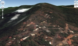
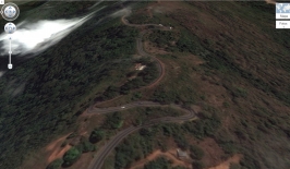
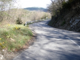
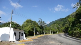
I would like to create this route; Los altos de Sucre, it's outside of my city, it's a perfect touge and rally route,it has fast, blind, and some tight corners.
Track Altos de Sucre 1.jpgTrack Altos de Sucre 2.jpgdddd.jpgdddddd.jpgP5010672.JPG17897560.jpg
 
What I'll call "Route De La Auto Union" with long sweeping bends seeing as the Streamliner can't do tight turns for Germany...

No GPS location but if it was a detailed course creator...
 
Back