CodeRedR51
Premium
- 55,260

- United States
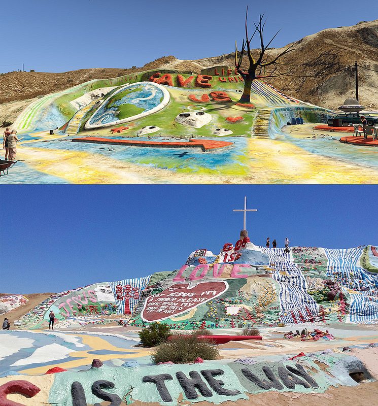
So I am planning a trip to California in May or June and plan on hitting up a few of the real life locations that are represented in GTA:V. I live in south central Arizona, so I will leave my work and get on Interstate 8 which is nearby. Take that to El Centro and head north on 111. That will take me along the east side of the Salton Sea. While there, I will make the following stops:

Then I will take highway 86 to Interstate 10 and head to Los Angeles. I will stay in the Glendale area, which will put me in prime position for:
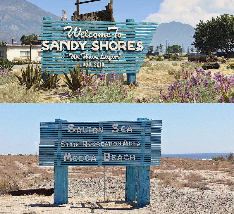
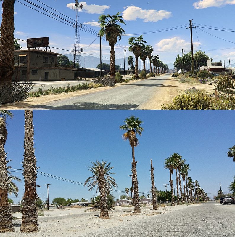
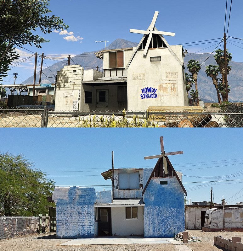
On the return trip home I will go back to highway 86, but instead of getting back on the 111, I will stay on the 86 and go down the west side of the Salton Sea. That will get me access to Desert Shores (aka Sandy Shores) and:

- Salvation Mountain (Beam Me Up)
- Ski Inn (inspiration for the Yellow Jack and the liquor store behind Trevor's trailer)
- Salton Sea Recreation Area Sign (Sandy Shores sign inspiration)
- North Shore Beach and Yacht Club (Sandy Shores Boat House) - Restored in 2010
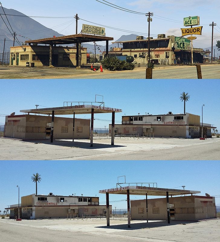
- Old Liquor Store/Restaurant (Liquor Ace was modeled after this building, though the design is flipped)
Then I will take highway 86 to Interstate 10 and head to Los Angeles. I will stay in the Glendale area, which will put me in prime position for:
- Griffith Observatory (Galileo Observatory)
- Hollywood Sign (Vinewood Sign)
- Hollywood Bowl (Vinewood Bowl)
- Santa Monica Pier (Vespucci Pier)
- Venice Beach (Vespucci Beach)
On the return trip home I will go back to highway 86, but instead of getting back on the 111, I will stay on the 86 and go down the west side of the Salton Sea. That will get me access to Desert Shores (aka Sandy Shores) and:
- Lorenzo's Gas Station (Sandy's Gas Station)
- Mountain View Drive (Algonquin Boulevard)
- Desert Shores Fire Dept. (Sandy Shores Fire Dept)
Last edited:
")