Quakebass
Premium
- 1,915

- Washington
- quakebass
Testing/Exploring the Terrain Maps in the GT6 Course Maker
OP Update 10/1/15 - Jump Tracks Comfirmed!

OP Update 10/3/15 - Rough Terrain Confirmed!

9/30/15 - Initial Tests & Findings
Sooo... This was kind of a thing back in the GT5 days - making tracks that resulted in obnoxious pile-ups and car-pocalypses. Inevitably, I'm sure some people (like myself) will start looking to recreate/relive these sorts of things with the new GT6 tool set, so I've started to explore the maps to see what can be done.
So far, I've only gotten to testing a few portions of the Eifel map, and haven't gotten a whole lot of satisfactory results - but there is still lots to explore and experiment with yet.
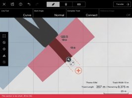
I've made around 20-30 layouts in this general area, trying multiple ways of laying road on on each hill/mountain on (so far) just the far left 1/4 of the map. Not much that I've created (again, so far) has produced anything satisfying or save-worthy, but I kept this layout to document my observations:
I'm not exactly sure what this thread will become - I'm mighty busy and won't have a lot of time to regularly update the OP with findings, but I feel like this could become a great resource thread for builders out there as more people start to play around. For now, I'm just going to be looking for stuff that causes air time and AI mistakes, as I feel the findings could give insights to both those aiming for jump tracks and those aiming for realism.
- Channels/wrinkles are benign.
One of the first things I explored were the small channels/wrinkles, as they appeared to be very extreme and sudden elevation changes:
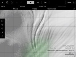

...However, they also turned out to be the least eventful. There was absolutely no dip or crest in the track, and I couldn't even see where the terrain was supposedly doing so. Because of this, there weren't really any pictures I could grab.
*This starts to become an image-heavy post from this point on, so I'm going to try to put as much content as a spoiler as I can. I apologize for the poor quality, as I don't have a proper capture device. I did my best to capture the best angles to depict what I observed, and included the track map so you could locate where I am in relation to the terrain map.
Observations so far:
- Track appears to smoothen out terrain.
Rather than going with the contours of the hills, many times it seemed like the Tarmac would "cut" into the terrain in order to flatten out the surface it was laying on. It was especially apparent in unloaded sections of track beyond the draw-distance, where you could see the track base. This may make it difficult to get more jolty or extreme elevation changes - and if it is the case, it may explain the lack of visible wrinkles:
- Steep elevation changes still exist
Despite the apparent smoothening of terrain, it's still possible to get steep hills going up and down mountains. I didn't find any extremely aggressive changes like GT5's Mt. Aso, but I'm still just scratching the surface with this thing:
- Crests and sudden/destabilizing elevation changes are still possible
Again, despite what I observed to be terrain smoothening, it appears that sharper changes in elevation can still occur at times - but It's still not nearly as aggressive as the stuff you could find in GT5. However, even being in the obnoxiously sticky Tomahawk, I was able to catch a small amount of air at a (relatively) low speed in the corner presented in the second image:
10/1/15 - New Method Found
Massive Breakthrough!
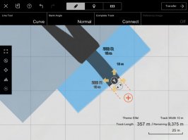
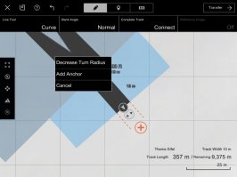
Credit for initial findings goes to @eran0004 and @NFSCARBON1 - they found that dense anchor points seemed to reduce the flattening/smoothening of elevation. I decided to make this the basis of my experiments, and fruitful, immediate results came from it. Thanks, guys!
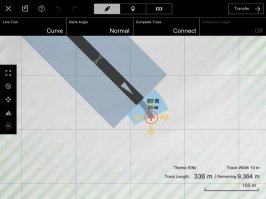
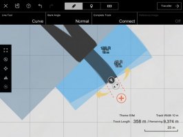
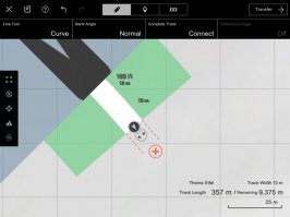
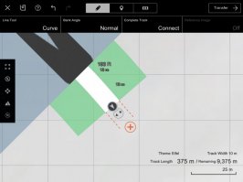
First things first, here's the layout I used:
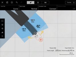
...Aaaaaand with all 121 anchor points visible:

- Re-visiting small channels and wrinkles
Just for fun, I decided to revisit the channels/wrinkles from the day before. That turned out to be the best decision I made, as it gave results immediately. There was terrain I had assumed to be benign after being flattened out by the standard track base in an earlier experiment, but, by adding dense anchor points, it appeared to get broken up a bit, and upon integration had the track largely follow the original contours on the terrain map. I didn't even have to make a single adjustment - beautiful, glorious bumps were there with the first course transfer. Jump tracks are now 100% confirmed:
- Banking may soften or sharpen bumps
Due to the excitement of an instantaneous jump track, I didn't do a whole lot more extensive testing - I just wanted to drive the thing and get it out there and into the world. However, since it's a very quick adjustment to change the banking severity, I set it to maximum steepness and exported a banked version to compare. There were some parts, largely on only one side (likely due to banking lowering/raising one side of the track to produce tilt) of the bumps that seemed softer or sharper than the original version. I tried to photograph these, but the differences just didn't really come across visually, likely due to my poor image quality. In my layout, it wasn't an extreme change, but this is just the first layout. There is a lot more experimenting to be done on this front - it could be affected more in other situations.
- Realistically rough/semi-rough road surface may be possible to create with extensive tinkering
While most of the bumps were large, there were a few smaller, more mellow bumps here and there throughout the track. Some of them really reminded me of some sort of road-rally stage - and as I've mentioned before, this came up in my very first iteration. I made no adjustments to this track after the first export (aside from the banking, obviously). There is a good chance that, as people begin to utilize this dense anchor point method, more complex, realistically bumpy surfaces could start to crop up in user-created tracks. This, like the last observation, was also very rushed and without much depth, but this one I can actually display visually. I've only really used hard-suspensioned sports and race cars in my tests so far, so even my physical analysis is limited, but here they are. This is definitely something I'm going to test more deeply sooner rather than later:
- Results/Predictions/Conclusions:
9/30/15 - I'd be willing to bet larger crests can be produced with further testing and more of the map explored. Also, basing on the Sierra track, the Andalusia location seems to have more aggressive terrain, and may produce even better results (of course, depending on your idea of "better"
 ). But there's still a lot of testing to do to know for sure.
10/1/15 - I've just opened a can of worms, here. I don't even really know what to try next - likely building a track with a larger lead up and runoff for larger jumps. But there's soooooo much more terrain to explore, now that we know the track can be affected by each and every little divet. Track width is probably a good thing to look at, and it'd probably be good to just take a few peeks at the other locations to see how much/if they differ from Eifel. There isn't much else to conclude on other than that jump tracks are very much alive and well, and that this is only the beginning - everything I built today was purely by accident, all in my initial test track. When people figure out how to harness (maybe even exploit) the tools available to us, I can't even begin to imagine what will be created. If anyone makes any observations or creations that give more insights, and can back them up with some sort of visual or screen grab, as long as it's plenty visible and clear what you're trying to show, I'd be more than happy to include it in an OP update.
- Notes:
- I haven't played with track width settings all that much yet.
- I used the Tomahawk VGT purely to make the process of screenshots and traveling around the track faster.
- I haven't tested with soft-suspensioned vehicles yet.
Last edited:


