So I decided I wanted to make a track.

11,308
United States
Marin County
Little back story: I was born and spent my childhood in the US state of Maine. For those of you unfamiliar with this little part of the world it is surrealistically idealistic. It's so pretty that it's actually bizarre. Couple that with the fact that BY FAR the largest city (easily double the size of the next biggest) has only 60,000 people and the result is a largely pristine, beautiful, and HUGE territory. Sprinkled throughout the coast are little fishing villages and harbors. Think Boston in 1740 and you get an idea. Of course because tourism is one of Maine's primary sources of economic viability, a lot of these towns are modified fairly significantly to be accessible for a lot of traffic. What ends up happening is you have these small little sea-side towns with dramatically radiused turns and wide roads, often to the point where they start to resemble race tracks. Boothbay Harbor, probably my favorite little town in Maine is probably the best example of this.

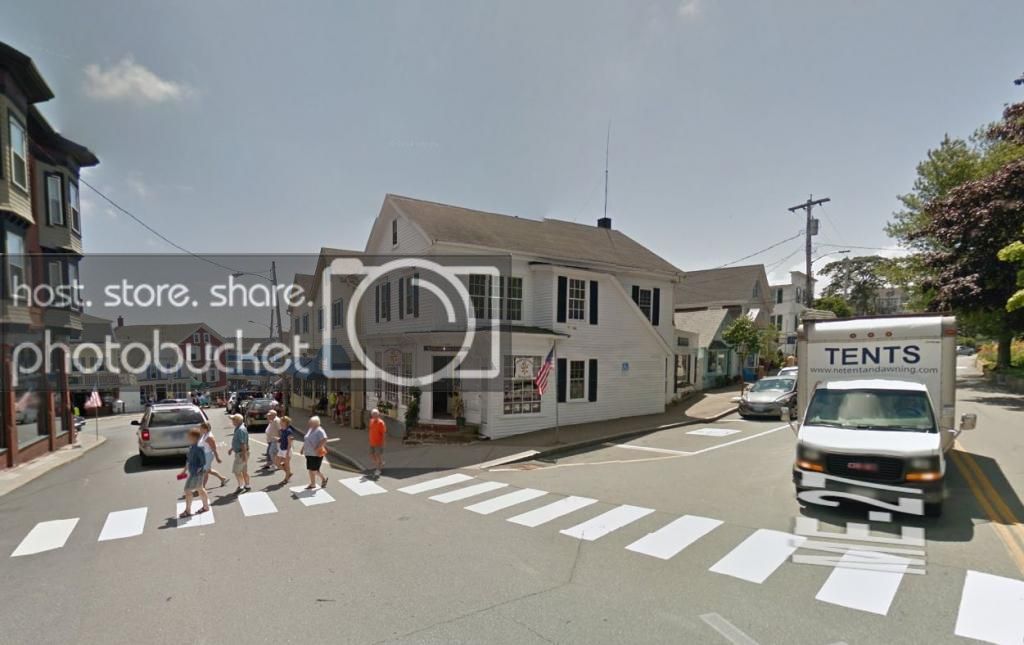
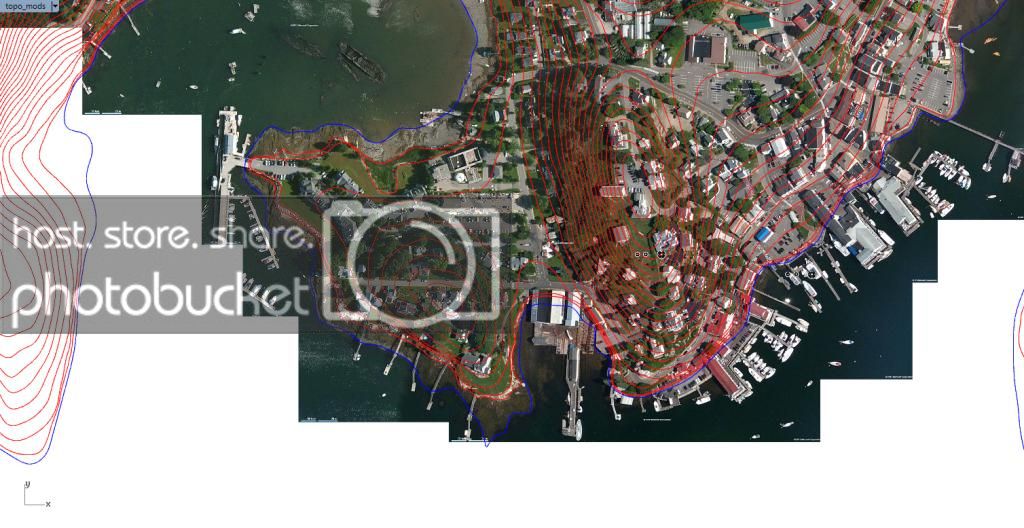
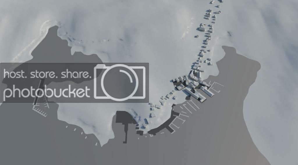
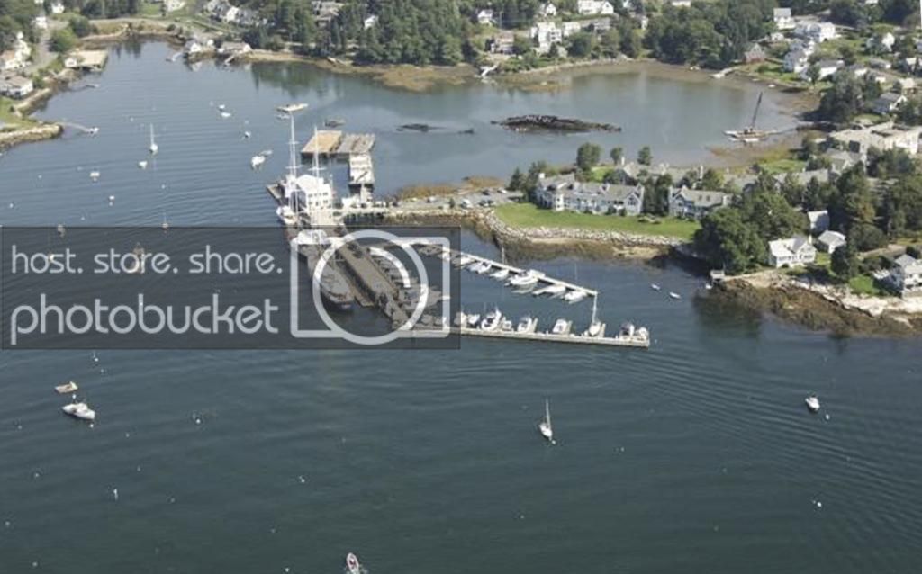
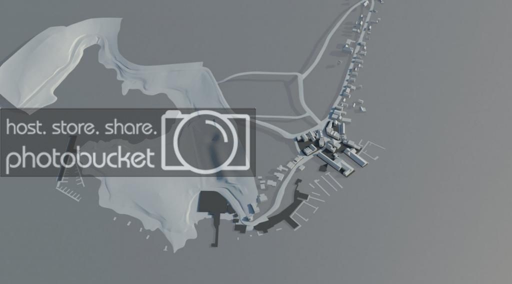
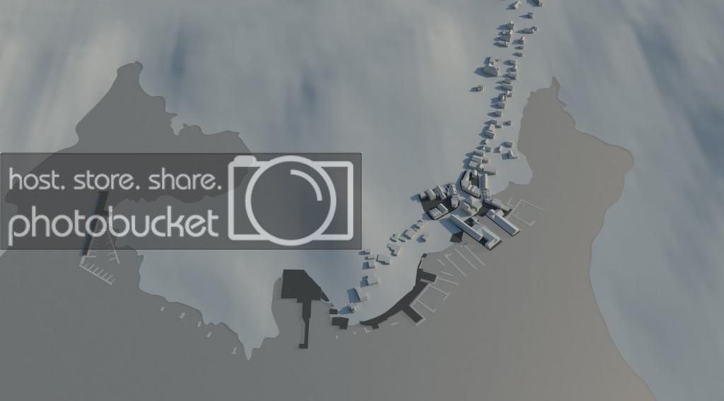
Here is a aerial view of the Harbor. The city proper is to the left of the main harbor.
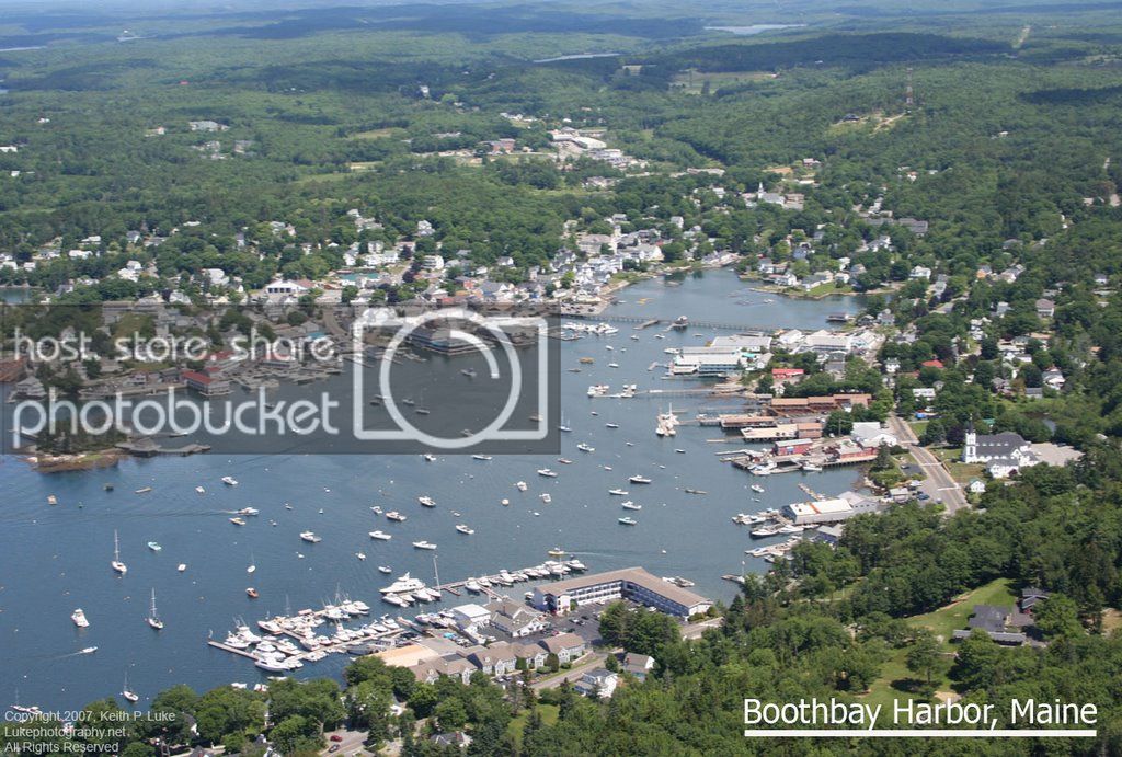
boothbayaerial_zps6ac1f356.jpg


Pretty, isn't it?

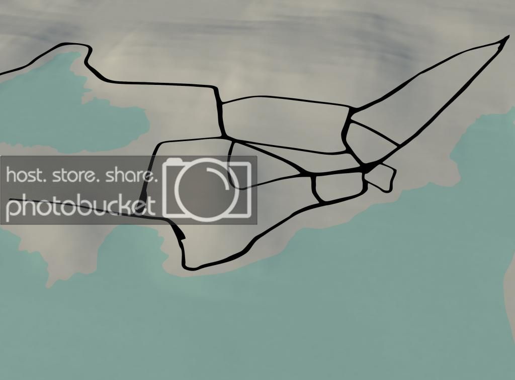
So with this in mind I started to look more closely at the streets and topography.

high_res_sat_zpsd7ee9901.jpg


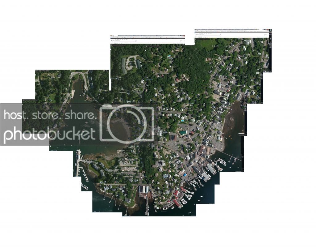
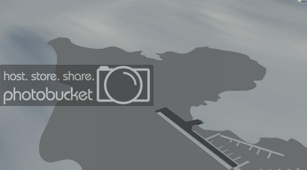
Its not really easy to tell the topography from an orthographic satellite view, but you can start to see the wide radius turns and interesting combinations of turns. So I started to draw some routes.

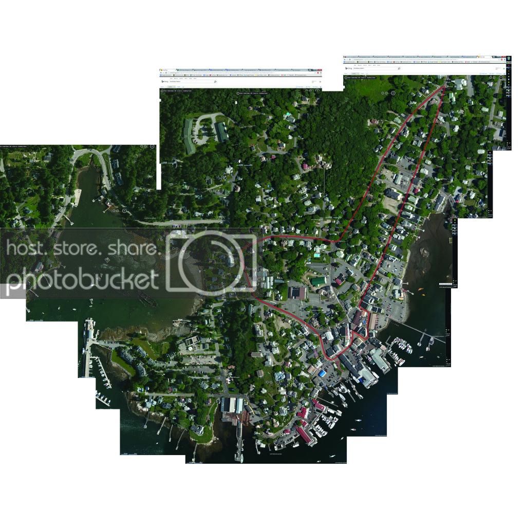
Seaside Run: (this one could actually go further than shown here, but this is the size of the image I composited)
seaside-01_zps93959090.jpg

The Warf:

TheWarf-01_zps3912c127.jpg

Downtown Loop:

downtown_loop-01_zps8e4eec6c.jpg


Boothbay GP:

boothbaygp-01_zps75cf1652.jpg

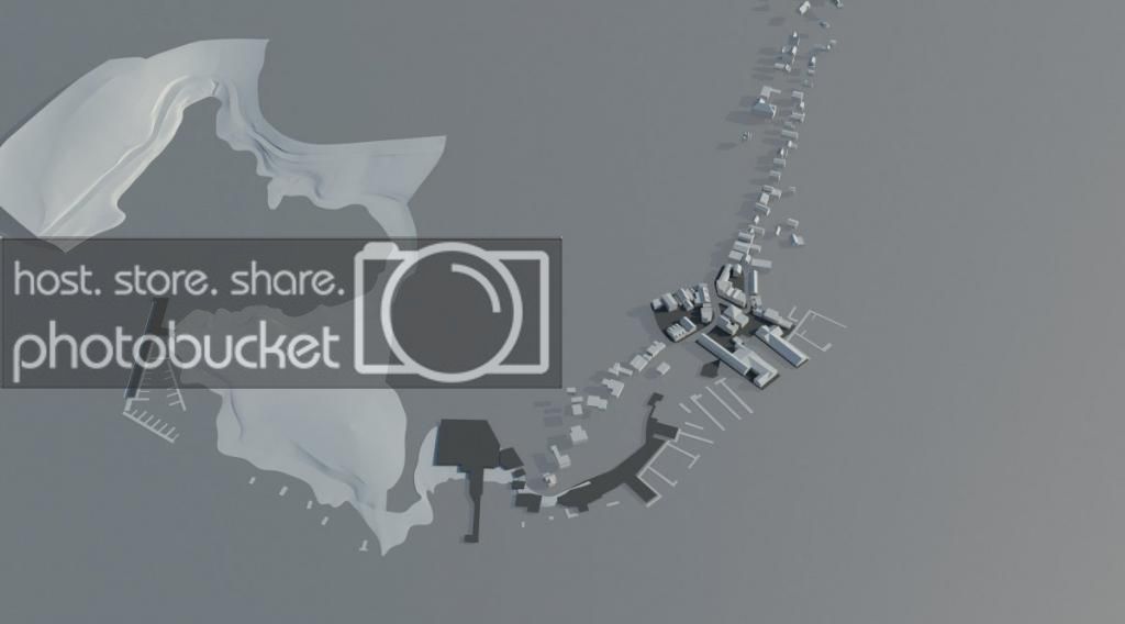
So with a few rough routes in mind, I've set about building things. I have a fairly decent set of modeling, rendering, and editing skills after 7 years in the field of architecture. So the progress I've made so far is modeling all of the topography, the roads, and starting to make progress on the buildings:
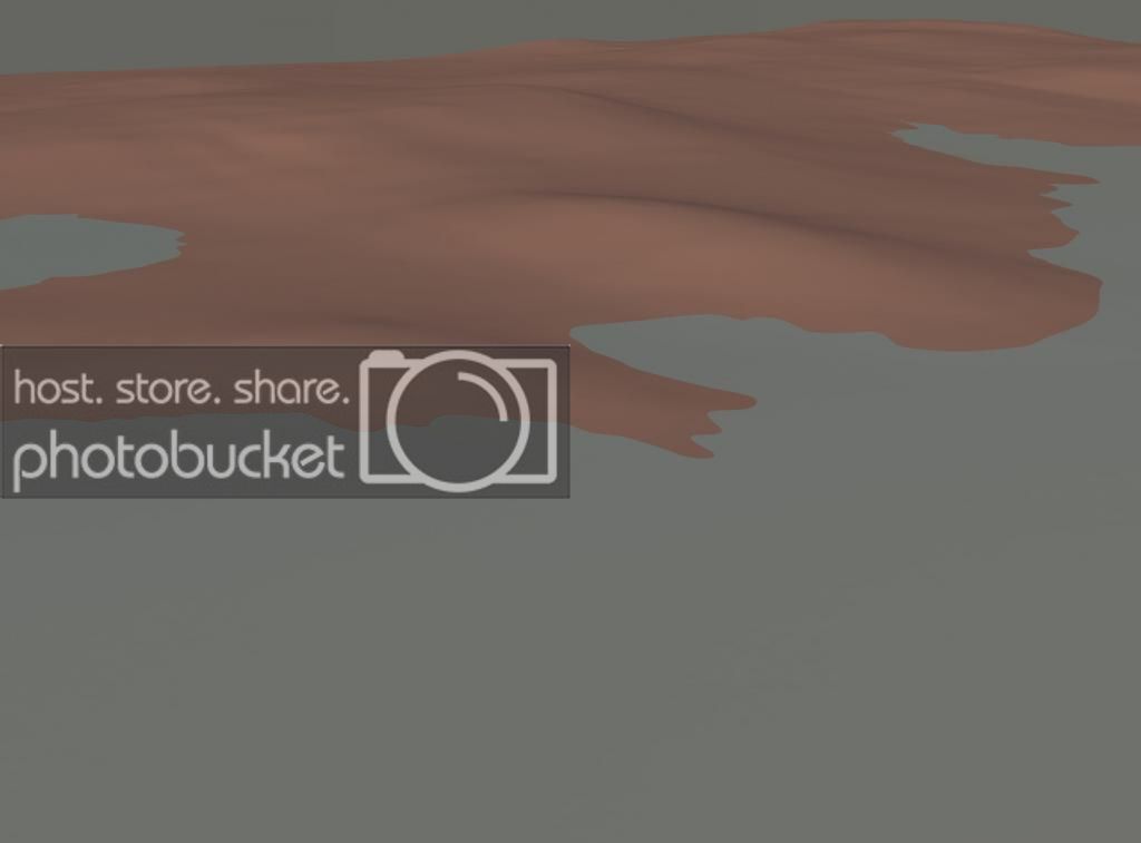
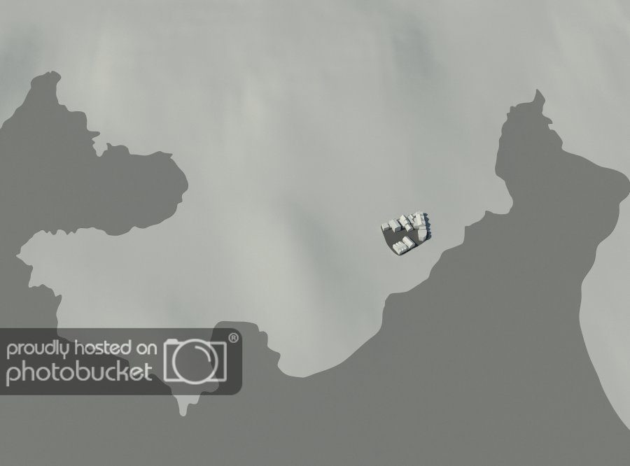
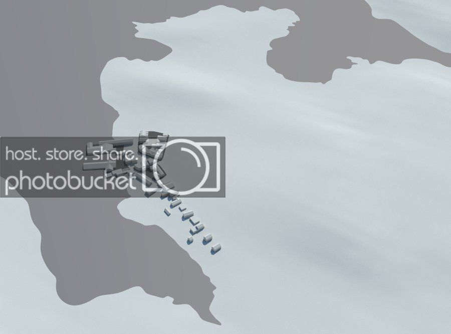
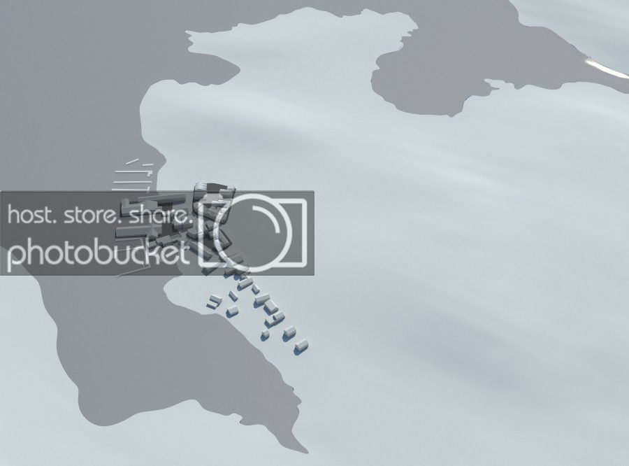
Bare Topo:
render_topo_zpscb7c6f6e.jpg


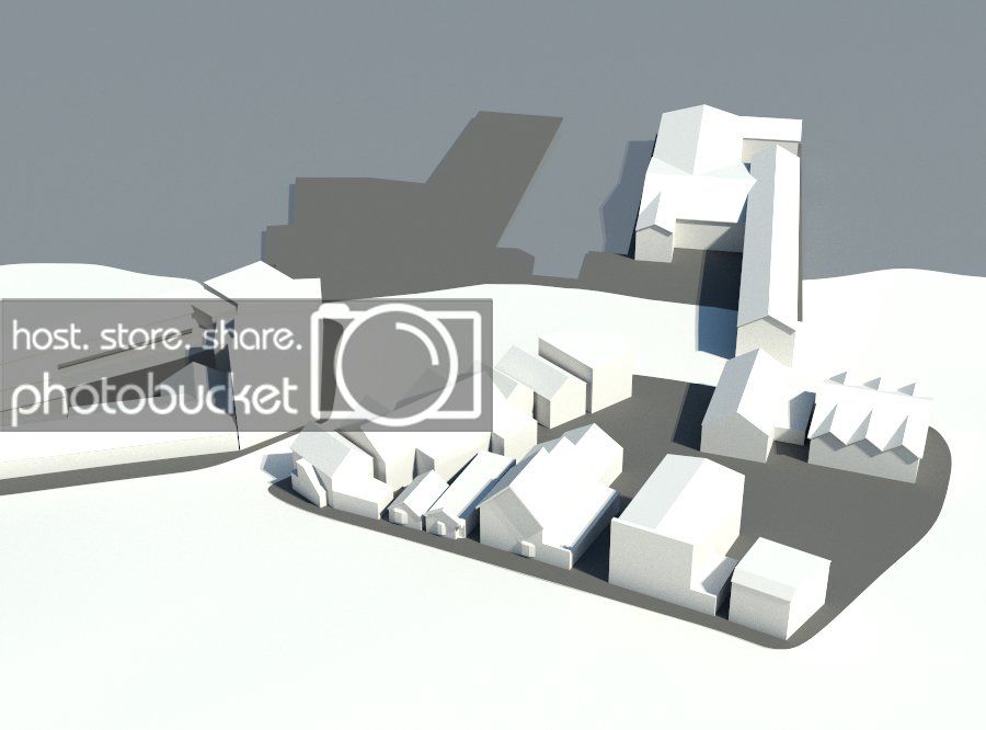
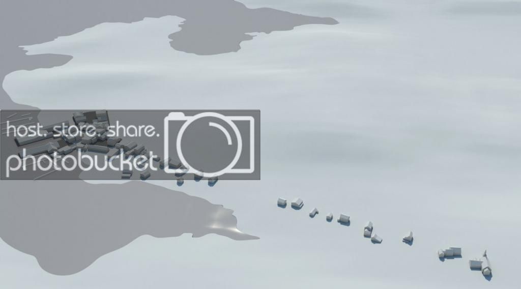
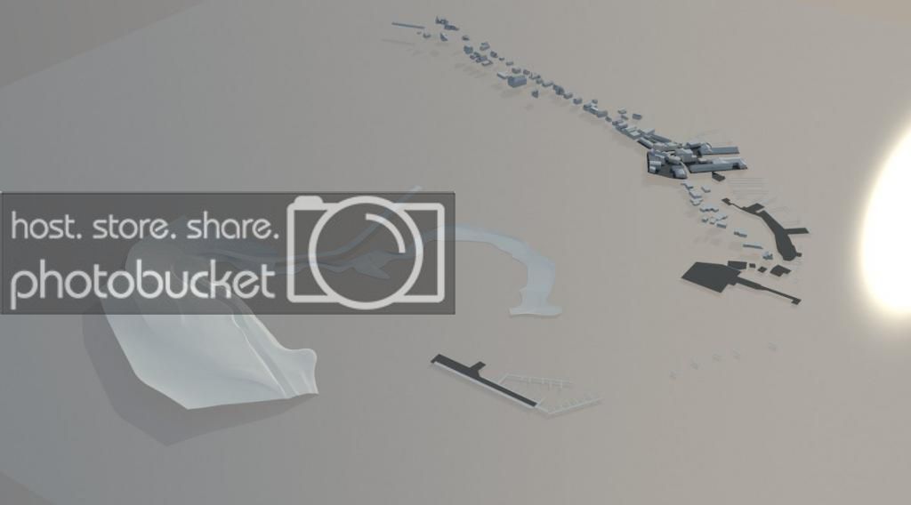
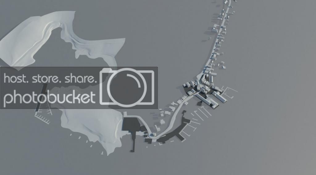
Primary Roads (Still working on this):

overall_zpsc046a061.jpg


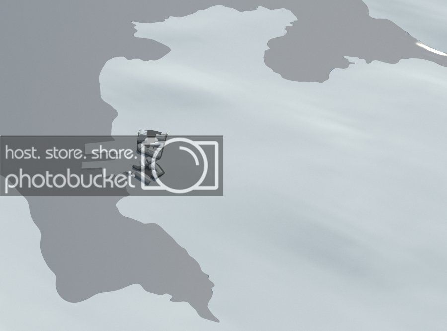
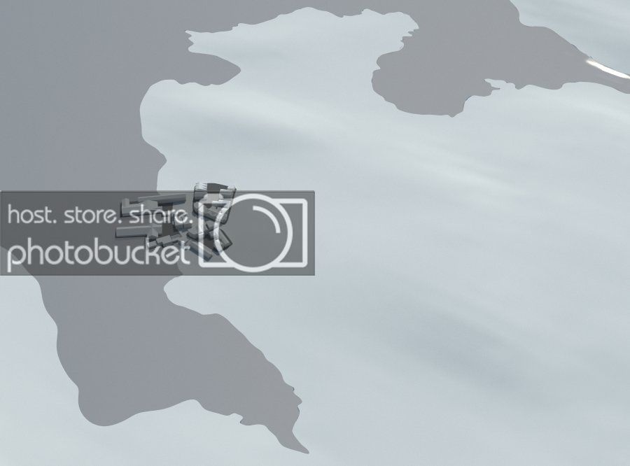
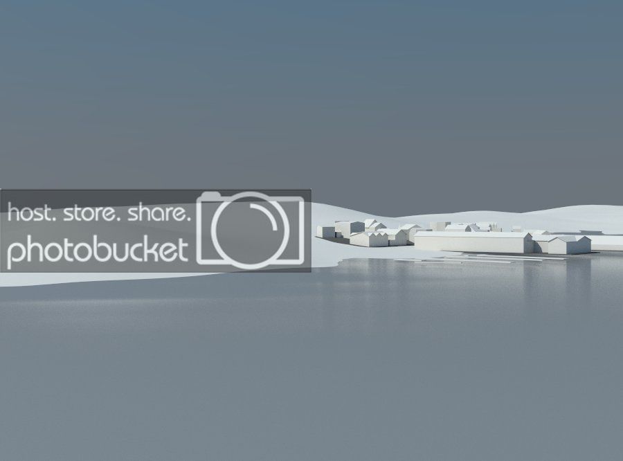
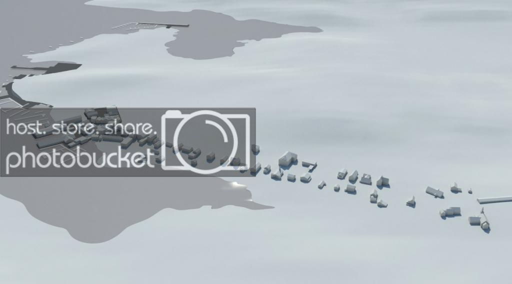
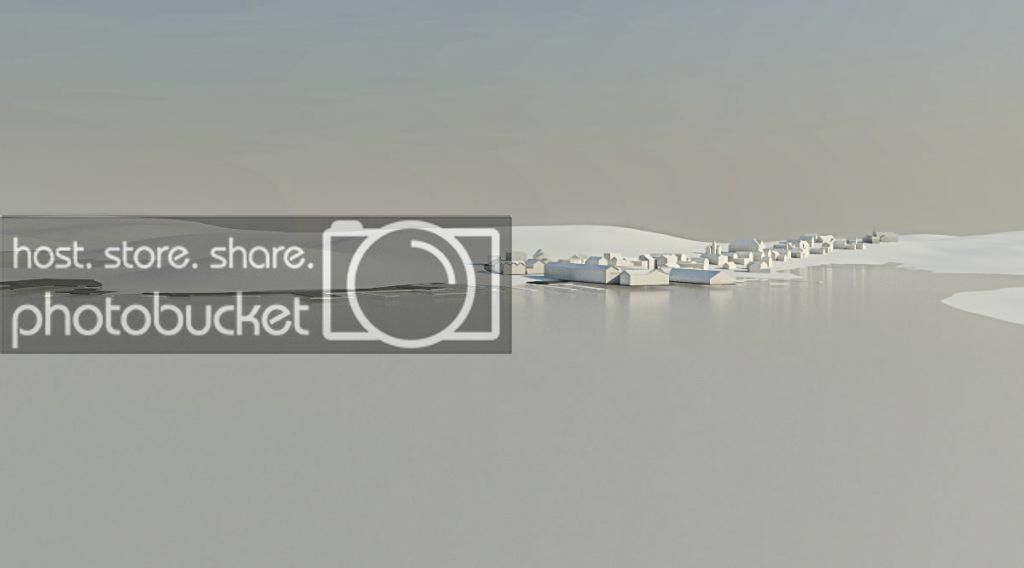
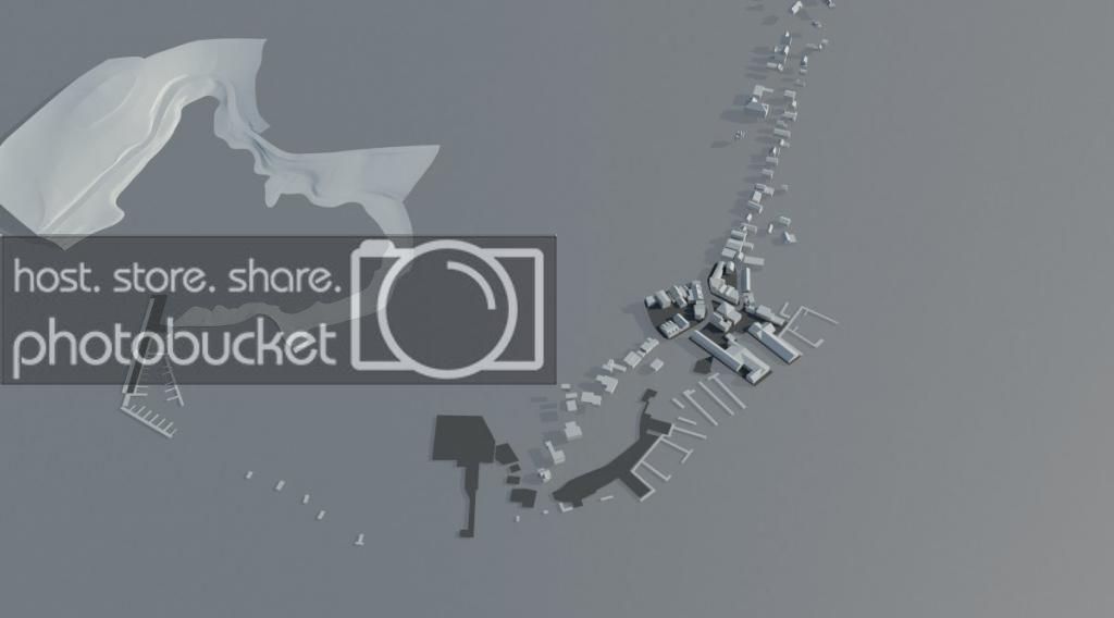
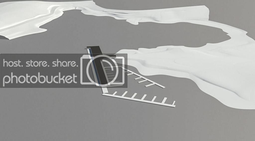
Buildings (Ugly render, sorry):

render_buildings_zps3dd82dd0.jpg


boothbay_zpsa020475b.jpg


zoom2_zps5cf721ae.jpg

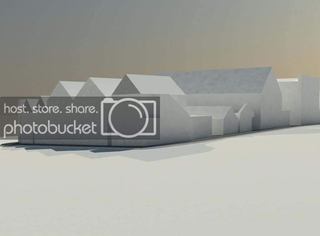
(The above cluster is the "island" just north of the most southern corner of "The Warf" proposed route)


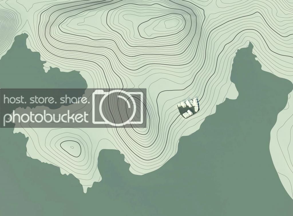
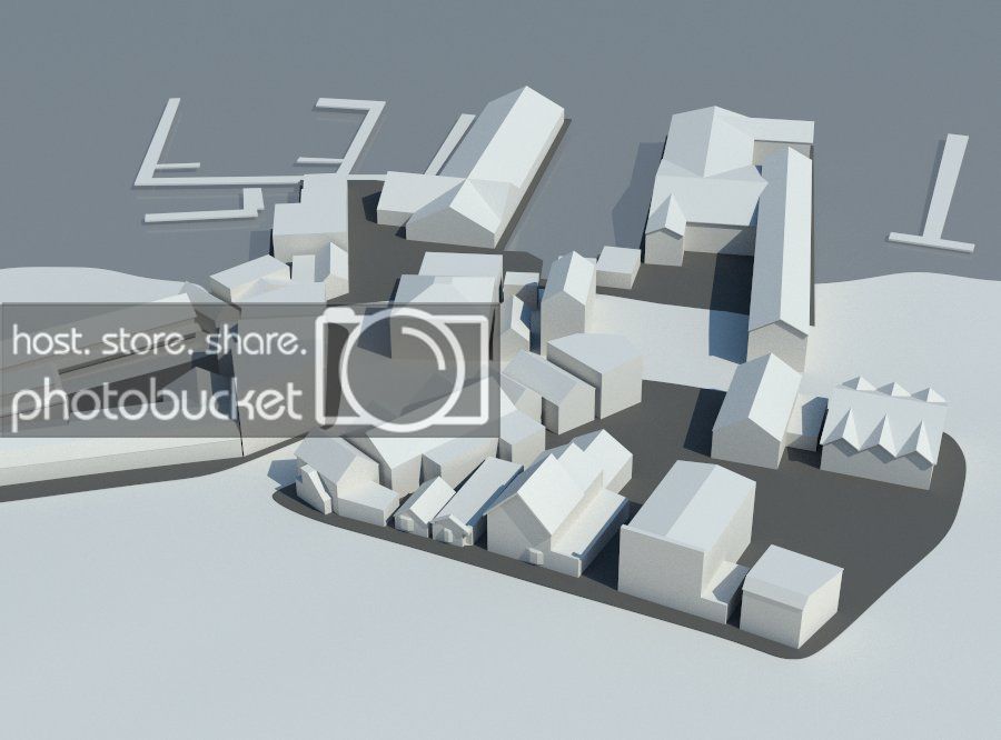
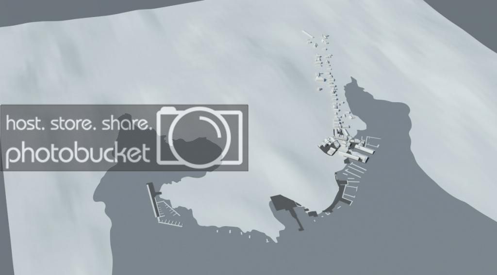
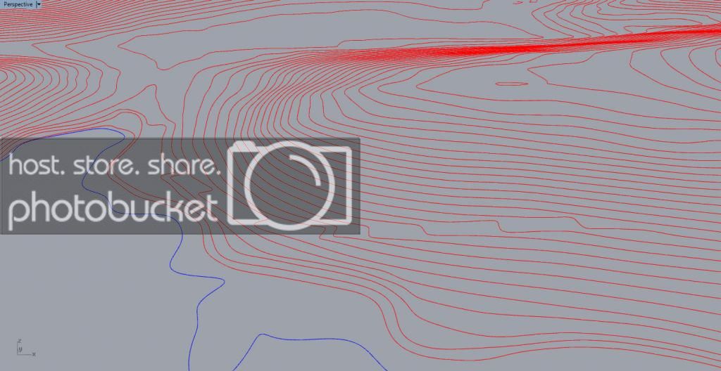
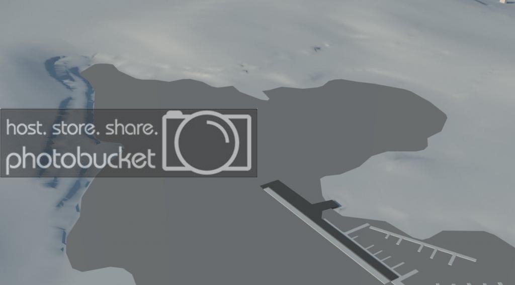
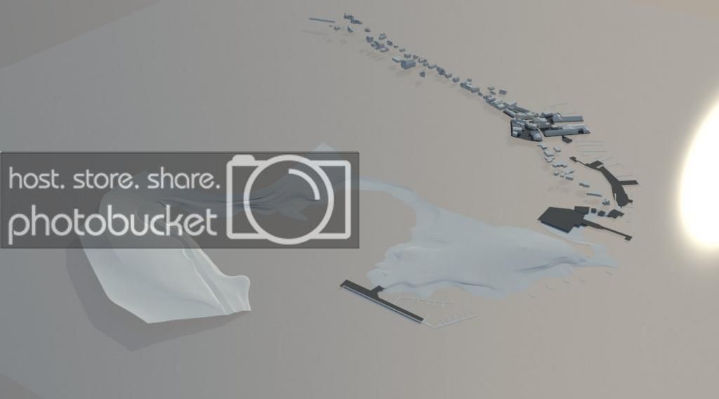
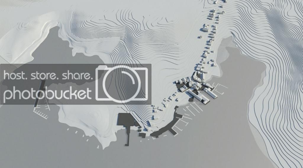
Topography with buildings showing elevation contours at 1m intervals:
topo_1_edit_zps15060ff5.jpg


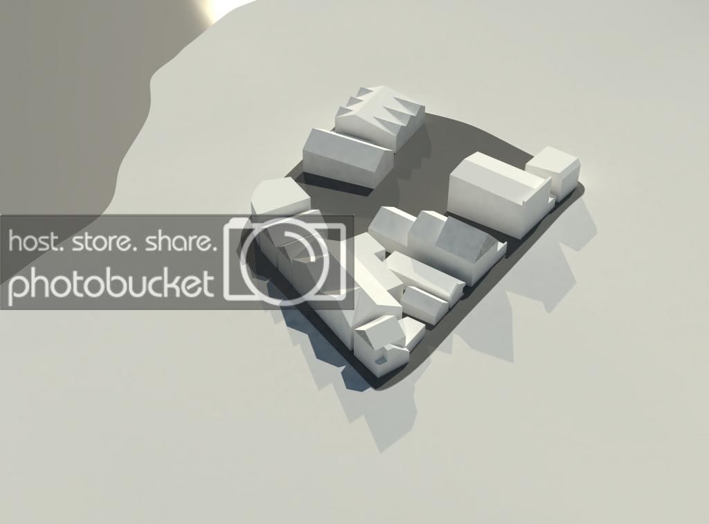
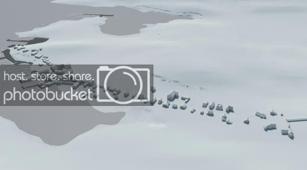
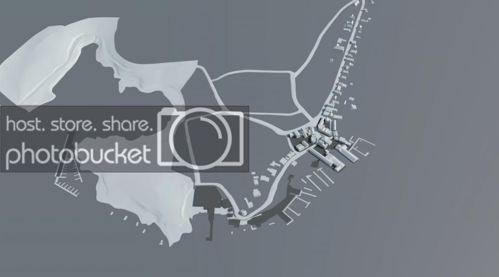
Composite (it's a little off because I used an orthographic view on a perspective render, but it should give an idea about density)
topo_1_edit_overlay_zpsd3909695.jpg


Obviously I have a ton of work to do, and with my final (thesis!) term about to start, progress is likely to be excruciatingly slow. I'm also working in Rhino, because I know it, and so everything is in NURBS format at the moment, not sure how that is going to mesh-out when it's ready to be put in the game.

While there is a lot of buildings to model, the area is fairly small. The longest of the routes (Boothbay GP) is a little less than 2 miles which I think should be a fun little circuit. It'll be somewhat similar to Tsukuba I think, except a little longer with a lot more elevation change and a lot narrower. I'm not going for 100% authenticity because I'll drive myself crazy trying to get the buildings just perfect. Basically I'll try to model some of the more notable ones accurately (as accurate as I can) and the rest can just be sort of approximate. We'll see what happens. If anyone has Blender/Maya/3DS-Max skill/experience and wants to help out, I'd love a little help with texture mapping later on.
 
Hope I can do this 10 years from now (I'm currently studying architecture and will soon learn Rhino). Maine is one of those states I don't know much about, but now it sounds interesting.
 
Very cool! Are you using Blender to do the modeling?

Rhino. It's somewhat like Maya but a lot more 'measured.' In fact, with T-splines, there really is no reason to ever use Maya, in my opinion. I'm no familiar with blender, I've never seen it used within the architecture community.
 
Rhino. It's somewhat like Maya but a lot more 'measured.' In fact, with T-splines, there really is no reason to ever use Maya, in my opinion. I'm no familiar with blender, I've never seen it used within the architecture community.

Oh. :dunce: It says it right there in your OP. Anyways, good luck!
 
Wow, great! And very interesting to see all photos of your progress. I keep an eye on this thread to see the next steps 👍
 
Worked on the buildings in that cluster a bit more. Found myself working on a chimney cricket and considering the direction it would be draining water....damn detail oriented nature....

Anyways, I think the slight modeling detail really helps. With some texture work, I think these will be plenty detailed enough. Also, I switched to my brute force GI rendering setup. Much better.

RENDERBUILDINGS5_zps75eb223b.jpg


zoomnew_zps2e861638.jpg


Part of my circuit isn't covered by streetview, annoyingly, so I'm gonna have to search for reference photos and guess.
 
Last edited:
I grew up in Cape Neddick, a little to the south of Boothbay. To say Maine is huge is a stretch. It's huge for New England and is sparsely populated. But once you go out west in the US you realize the place is tiny. It is roughly the same size as south Korea, which is a tiny country. It is one of the smaller US states. But when you take a road trip in Maine it does seem like a really big place and different parts of the state have their own personality. Boothbay is a sleepy little fishing/tourist town- it stands in stark contrast to anything to do with racing LOL. But the roads are rollercoasters and perfect for a fantasy track like this.

This is an interesting idea because the roads are small and twisty- perfect for a rally stage and some towns could be made into a wicked nice racetrack with some improvements. The roads around Cape Neddick would be perfect for this too and the view is amazing along the coast. When I was a kid I used to take Shore Rd like a rally stage and what a blast it was. I can't wait to race the Boothbay GP! Ayuh, it'll be a pisser track for sure.

I suppose I mean it's big for a largely uninhabited area. Its 3/4 the size of the country of England. It's not a small place.

Another idea I might incorporate is a point-to-point starting from east Boothbay and going west and down Southport Island to Newagen. That is a very large area though and would probably be close to 10 miles. In either case, the biggest amount of work will be the town itself, so that's what I'll focus on first. Southport Island is mostly just trees.
 
Don't know if you're looking for this stuff or can use it, but I found some trees on RaceDepartment.
 
There are a lot of buildings. I'm trying to model them quickly and efficiently, but even still some of them take more than 20 minutes. But, here is some progress:

1415_2005_zpsf0fee5dc.jpg


1415_2041_zpscce022f6.jpg


15151717_zpsa03eaae2.jpg


1615_0150_zps60e1f483.jpg


1615_1433_zps62c5cabd.jpg


overall_zps023f44fe.jpg


I'm finding that the KML data I used (via google) for the topography is pretty inaccurate in a lot of places. What I'll probably do is contour the whole thing out into control point curves, readjust them as necessary, and then loft them again. It will take a while, but I think the accuracy of the topo is very important for this project.

And a sunrise money shot:
money_zps5c4dde24.jpg


I think it's starting to look like a real city :P

The woman comes back from California today, so there might not be updates for a while. :)
 
Last edited:
Started digging into the topography, so to speak.

This was the topographical data I started with (a small portion of it, with the contours extracted)
topo_editing_zpsc9d96e67.jpg


As you can see, the topography contours don't really jive with the satellite imagery, so I've been going through and correcting them and rebuilding the surface:

topo_editing2_zps00f182e1.jpg


Basically I'm using my own intuition to judge the vertical nature of the ledges around the water. I'm also beginning to refine the topography around the road surfaces (the ones that will be driven on, for now)

roads_modification_zps95d61dcc.jpg


Also made some progress on the buildings, but nothing worth doing a rendering for.

These will be my last photos uploaded to photobucket. The compression is heinous. Flickr here I come.
 
Well here is the first run of the re-formed topography. It needs a lot of refinement, but it is already much more accurate than before.

Before:
1615_0150_zps60e1f483.jpg


After:

11415_0114_zps41588ade.jpg


Before:
overall_zps023f44fe.jpg


After:
11415_0149_zps585a4868.jpg


Before:
before_zpsf517672b.jpg


After:
after_zps0e46cbdb.jpg


It will be a slow process of refinement, but i think it will be worth it.
 
Last edited:
Good news! I figure out a good method of refining the topography via a command I've never really used....curve network! It actually works wonders. It will take a while, but the results are looking pretty good to me. Here is a quick before & after teaser:

Before:
refinementbetterviewbefore_zps82d5ec3b.jpg


After:
refinementbetterviewafter4_zpsf6e53717.jpg


And kind of a schizophrenic view showing my progress. I've got a long ways to go....
schizo_zps951297a9.jpg
 
Bit of an update:

From last time:
115150000_zps4f6b0081.jpg


115152004_zpsde87b2c8.jpg


115152326_zps63b80047.jpg


115151743_zps83f05f86.jpg


115152323_zps64b40c50.jpg


Here is a little comparison of McFarland Point

7925_zpsa216073b.jpg


comparo_zps5c86f309.jpg


Not too bad I don't think. Need a lot of trees....

One last one for this update. A bit of a composite of my refined topography and the contours turned into planes. Came out pretty sweet I think.

moneyshot_zps29e29101.jpg
 
Steadily making progress:

119151453_zps4341bd2a.jpg


All course road beds modeled:
119151629_zps274f8e7f.jpg

(The actual roads will sit on top as a different object, to make sure they are more smooth and uniform)

Big hill #1 progress
120151637_zpsf057f346.jpg


Big hill #1 revisions and progress
120151842_zps5c6a2f4d.jpg

I'm using an enormous amount of artistic license to fill in the gaps of what I can't discern from the information I have. But in general, I think its actually fairly accurate.

And just to illustrate, again, the difference from the terrain I started with this to what I have now:
unrefined_zpsa0e9a5a6.jpg


Its like one is out of focus :P
 
I can't wait to race the Boothbay GP! Ayuh, it'll be a pisser track for sure.

Cmon, All New Englanders know the correct term is, wicked pissah. Since when did we staht using the letteh R ?

Will be following this thread. Great Job. I was married in Boothbay 17 years ago. Great memories.
 
Cmon, All New Englanders know the correct term is, wicked pissah. Since when did we staht using the letteh R ?

Will be following this thread. Great Job. I was married in Boothbay 17 years ago. Great memories.

People who know Boothbay will see this project as one of the strangest and random they've seen. But that's ok. :)

Haven't made much progress in the past few days...

...because thesis.
 
In my brain I said wicked pissah, but that woulda sounded awful odd to all these flatlandahs. She's looking wicked good too.
 
I'm just discovering the AC world now as my pc is due to arrive soon, and i must say it surprises me how people can make these tracks with scenery + all the bells and whistles just by themselves. Really impresses me and @Eunos_Cosmo when you will have finished this track over time (and i hope it will look just like the real thing ;)), i'm sure it will be one of your life works that you can be very proud of. Great stuff and a pretty location too 👍
 
Tremendous work!
I would have loved to help out, if I knew how to use the programs, I only have Inventor and Solidworks Knowledge.
 
Back