

The GTPlanet world map 04/16/2014 update

  • Thread starter Thread starter UnoMOTO
  • 1,455 comments
  • 171,173 views
Leavenworth County, Kansas.
 
Sweden

EDIT: The islands Öland and Gotland should be colored blue, as they belong to Sweden.
 
My first claim of England doesn't feel that special anymore.
 
Well my "home" country of England seems to have taken the lead, but I'm putting my "pin" in my current home of California.
 
So what does the tan Kentucky signify?
 
I have also paid tribute to Jordan the site owner by getting a unique color to signify where it all started in the great state of Kentucky.
Was his name-o.
 
Ah I see, guess that's what I get for skimming through the comments. :lol:
 
Sweden

EDIT: The islands Öland and Gotland should be colored blue, as they belong to Sweden.

Thanks.👍

Why not make one of these?

Just a dot on the map doesn't have the effect I was looking for. Thanks for the tip anyway.

 
I am from Lynnwood, Washington, USA.:)
 
Victoria, Australia.
 
I didn't know this many Aussies were on GTP!

EDIT-Are you meant to tell us when we have been counted or not?
 
Last edited:
In lieu of the info about Kentucky, what happens if it just happens to get more than 10 people?
 
EDIT-Are you meant to tell us when we have been counted or not?

No need for that. I've got everything under control. I think...:nervous:

In lieu of the info about Kentucky, what happens if it just happens to get more than 10 people?

Will Kentuckians feel cheated by not changing colors? Since I haven't had an official check in of one, we may never know.
 
Chris from Kentucky here!!

Is Jordan really from KY? It's not a very populated state. Wonder from which side he resides.
 
Last edited:
Posting. Wanting to be counted.

Another Scot from Scotland here. Och aye the noo, and all that.
 
Offtopic: Why are some of the USA states so square?
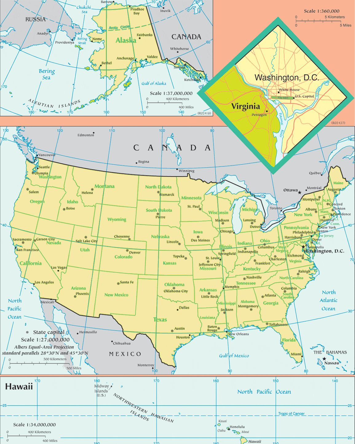
Edit: I mean why are they divided like that?
 
Offtopic: Why are some of the USA states so square?

Some borders are based on rivers, others, as you've noticed, are based on latitude and longitude.

usa-map.gif


And what daan said.
 
Offtopic: Why are some of the USA states so square?

Edit: I mean why are they divided like that?

Because their cars can't do corners.
 
But do you go right?!
 
New Jersey (Nu Joisey) USA :p
 
One more GTP reader from Belgium here :)
 
Checking in from Ohio .
 
Back