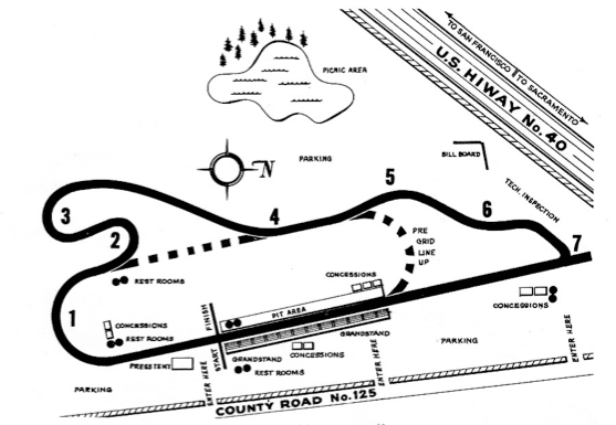
It's basically a hotel at the track for the drivers. The proposed location of that track was in the middle of nowhere, so having a driver's village was a convenience.Please excuse my ignorance but on that map it points out "driver villages" What is that? I'm not familiar with that term
Please excuse my ignorance but on that map it points out "driver villages" What is that? I'm not familiar with that term
Okay I'm sorry, but surely they weren't that stupid that they thought it wouldn't be noisy on race days/nights.

Judging by the satellite image, on the east side of that neighborhood appears to be what was/might have been the turn 3 and 4 side of the track still sort of visible in the line of trees. That's my amateur guess at it though. The road in the aerial image of the track doesn't appear to be there anymore either, which makes it a bit more difficult to pinpoint the track's location and Google Earth imagery in that area only goes back to 2004, so that's no help either, although 2004 imagery appears to show the possibility of the turn 3 and 4 side of the speedway.My avatar over there is from the drag/oval that was in my home city, it was used from 1961-92. Complaining home owners and the fact the land was worth more not being taken up by a track killed it.
I don't know how to post a google map pic so heres a link. The track was where that small new community is. @Johnnypenso do you know exactly where it was?
https://www.google.ca/maps/@42.2761574,-82.8809836,643m/data=!3m1!1e3
Here? http://www.speedwayaustralia.net.au/companies/63/95/Bunbury-City-Speedway/IIRC, Bunbury raceway in Perth was a proposed circuit, I believe they started to build it in '99, But I can't find any relative information on it other then its "proposal" anyone able to help?
That's a site I didn't know about. Think it might be useful...
I believe it also sources a wikipedia list, without actually sourcing it. I tried using that site but it lacks any good info to be useful.This is the site I've always used but sadly it's just NA tracks listed.
http://www.na-motorsports.com/Tracks/
I've done a bit of reading and apparently there has been a few tracks in my city, one of which may still be there overrun by trees. Hope to look into it once my kids are no longer sick.
I'm not too sure what happened to it but I think I recall the circuit hoping to get some international, mainly Asian, series' running there. Shame it never happened, at the time I was excited about another track for the V8 Supercars to potentially go to. Would've been great to have another permanent circuit in the country too.IIRC, Bunbury raceway in Perth was a proposed circuit, I believe they started to build it in '99, But I can't find any relative information on it other then its "proposal" anyone able to help?
Just ran across this by accident. I moved here in 95' so Checkered Flag was before my time. I did read one of the links you provided and some of the guys that raced there like Earl Ross and Norm Lelliott, I saw race up at Pinecrest Speedway in Maple, just north of Toronto when I was a kid. I saw Don Mallat's name in there too. I sponsored his Cascar Stock Car in 1996 or 1997 and got to drive a few laps on sponsor day at Deleware after the season.My avatar over there is from the drag/oval that was in my home city, it was used from 1961-92. Complaining home owners and the fact the land was worth more not being taken up by a track killed it.
I don't know how to post a google map pic so heres a link. The track was where that small new community is. @Johnnypenso do you know exactly where it was?
https://www.google.ca/maps/@42.2761574,-82.8809836,643m/data=!3m1!1e3
500 hp on a 1/4 mile oval

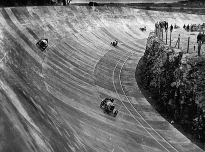
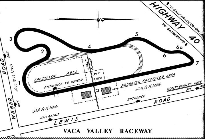
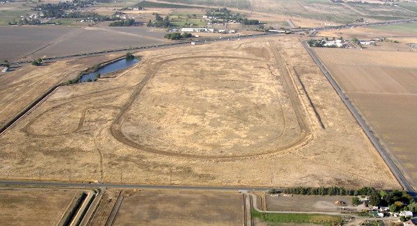
Nice find.Vaca Valley Raceway was once a Oval Track, drag strip, and SCCA touring car circuit back in the 50s and 60s located off of Highway 40 (now called Interstate 80) near Vacaville, California. Due to funding issues, this track was eventually closed and was abandoned since 1971.
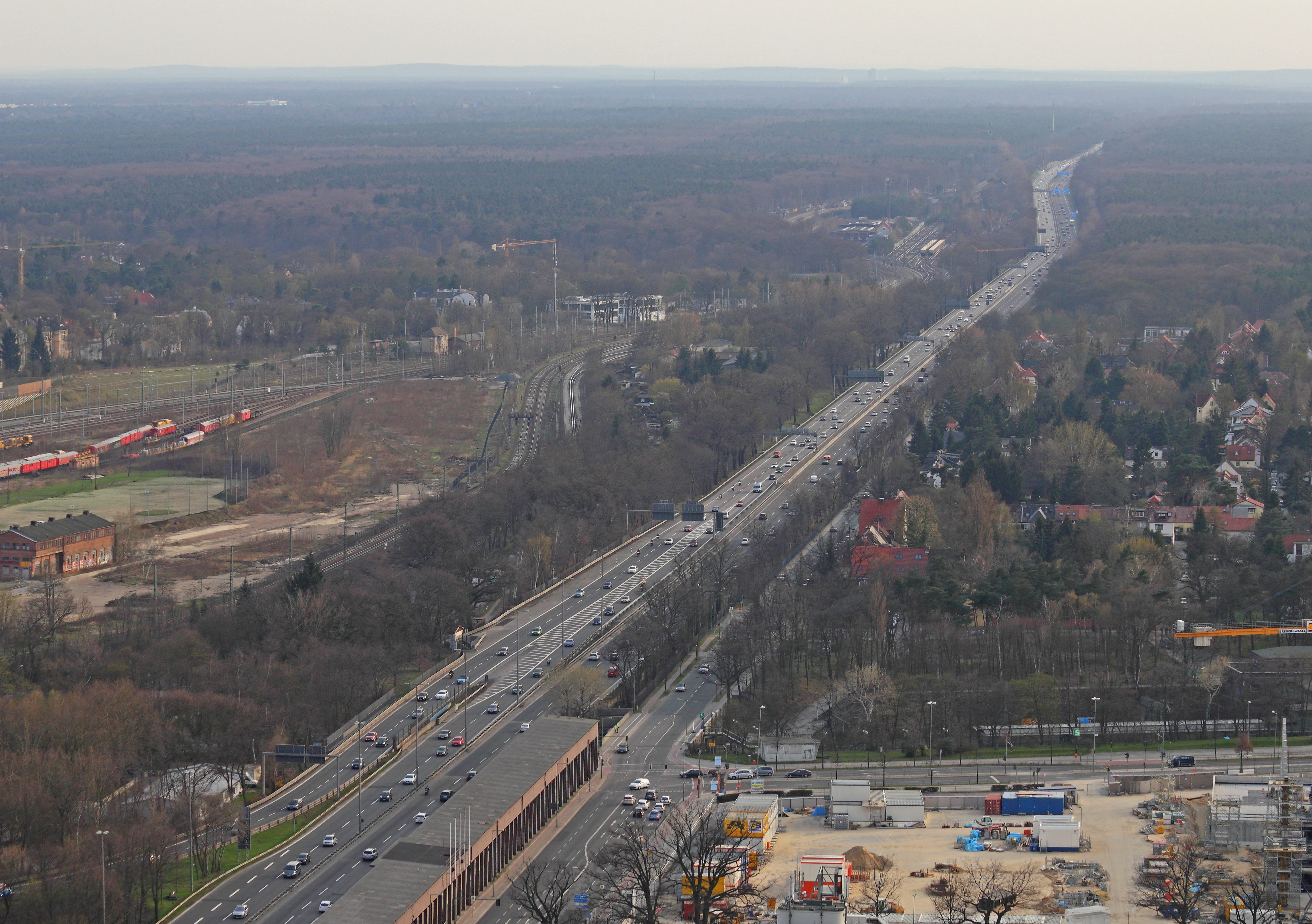
Here is how it looks today as seen from a bird's eye view. The track is almost taken over by the forces of mother nature, but the lining of the track still remains.
") That aerial photo make it look like there was a lawnmower race held there recently.
That aerial photo make it look like there was a lawnmower race held there recently. Nice find.
Out of curiosity, which way did the dragstrip run, from the Oval to the hairpin? Though my NHRA instincts would have me thinking of putting the shutdown area gravel traps and netting at the Oval end ala Brainerd(sp?).

And did the golf course come in before or after the track closed? I assume it was the latter.Here's how Cranbrook International Speedway on the other side of BC looked in the last google earth map:
Fox ArticleAll that’s left now is skid marks and the broken memories of a NASCAR champion.
Longer. The last race at North Wilkesboro was in the fall of 1996.I'm guessing its been more then 15 years since top level NASCAR raced here, such a shame, so much history being reclaimed by the elements,