- 24,770

- Anoka, MN
Isn't that were they filmed the test session of Cole Trickle in days of thunder?
That was Charlotte, Rockingham was used in Talladega Nights though.
Isn't that were they filmed the test session of Cole Trickle in days of thunder?
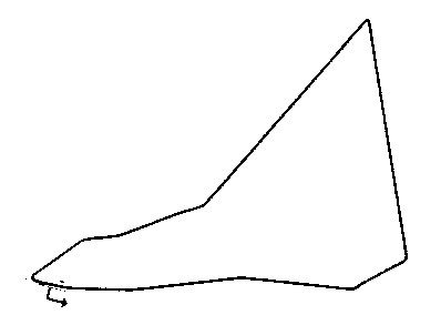
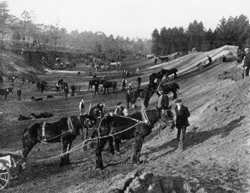
When I first saw the new Hockenhiem, I didn't like it much, although I understood the reasons the changes were needed.Some late breaking news. That above is not the original Hockenheimring. This below is the original original Hockenheimring. The one above was laid out in 1937. When the track very first opened as a test track in 1932, it used other lanes and backroads in the forest which wouldn't be revisited and looked like this:
1932-1937
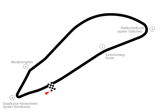
1937-1963
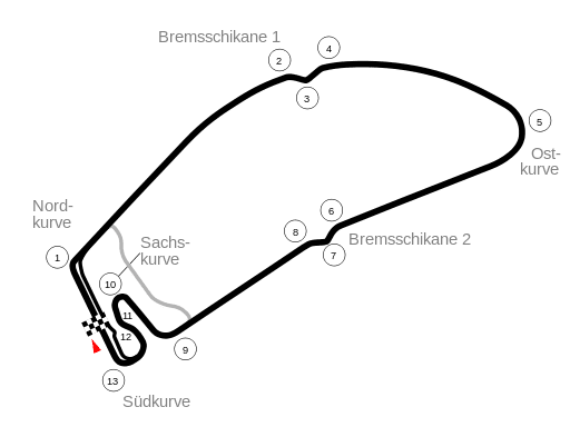
1964-2001
With some cosmetic changes to the Ostkurve over time.
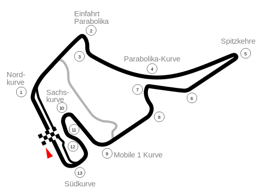
2002-Present
") . You can build good speed through T8 down towards T9, which helps preserve the old feeling of this corner. Of course, the approach is not as fast as it used to be, but it's still quite quick.. I think it's a great example of how you don't need a ton of banking or elevation to make some exciting corners.
. You can build good speed through T8 down towards T9, which helps preserve the old feeling of this corner. Of course, the approach is not as fast as it used to be, but it's still quite quick.. I think it's a great example of how you don't need a ton of banking or elevation to make some exciting corners.To me, the exit of T2 and T3 are the weekest points on the track. Not the easiest to navigate, but could be more exciting. I think the straight between 1 & 2 could have been slightly longer, T2 closer to 180', and then connect it back to the long, curved straight down to T5.

You can also see remnants of the two final corners which were bypassed (around 1954-55) for the construction of the banking, which gives us the Parabolica as we know it today.
See, that's always bugged me. Going from the Wikimedia Commons files on the Monza layout:
The original 1922-1935 layout has a Parabolica
The 1935-1937 layout avoids it
The 1938-1954 layout layout has it severely chopped into a double right hander
Then the layouts from 1955 onwards have a Parabolica again! Albeit reprofiled over time like the Lesmo.
It seems like such an effort to have that corner, get rid of it, then have it back again. I can't think of many circuits where a corner has vanished only to return.
See, that's always bugged me.
The modern Parabolica shares little with the old pre-war Curva de Vedano, apart from both corners connecting the same two straights. The original pre-war corner was located further north than any of it's successor corners and was a constant radius curve. During the 1938/39 renovations, the banking was demolished and they built the double right hander (the one that you can still see traces of in your photo) at the location of the former south banking. The old south banking was either completely gone or at least disjointed at that point.The original 1922-1935 layout has a Parabolica
The 1935-1937 layout avoids it
The 1938-1954 layout layout has it severely chopped into a double right hander
Then the layouts from 1955 onwards have a Parabolica again! Albeit reprofiled over time like the Lesmo.
It seems like such an effort to have that corner, get rid of it, then have it back again. I can't think of many circuits where a corner has vanished only to return.
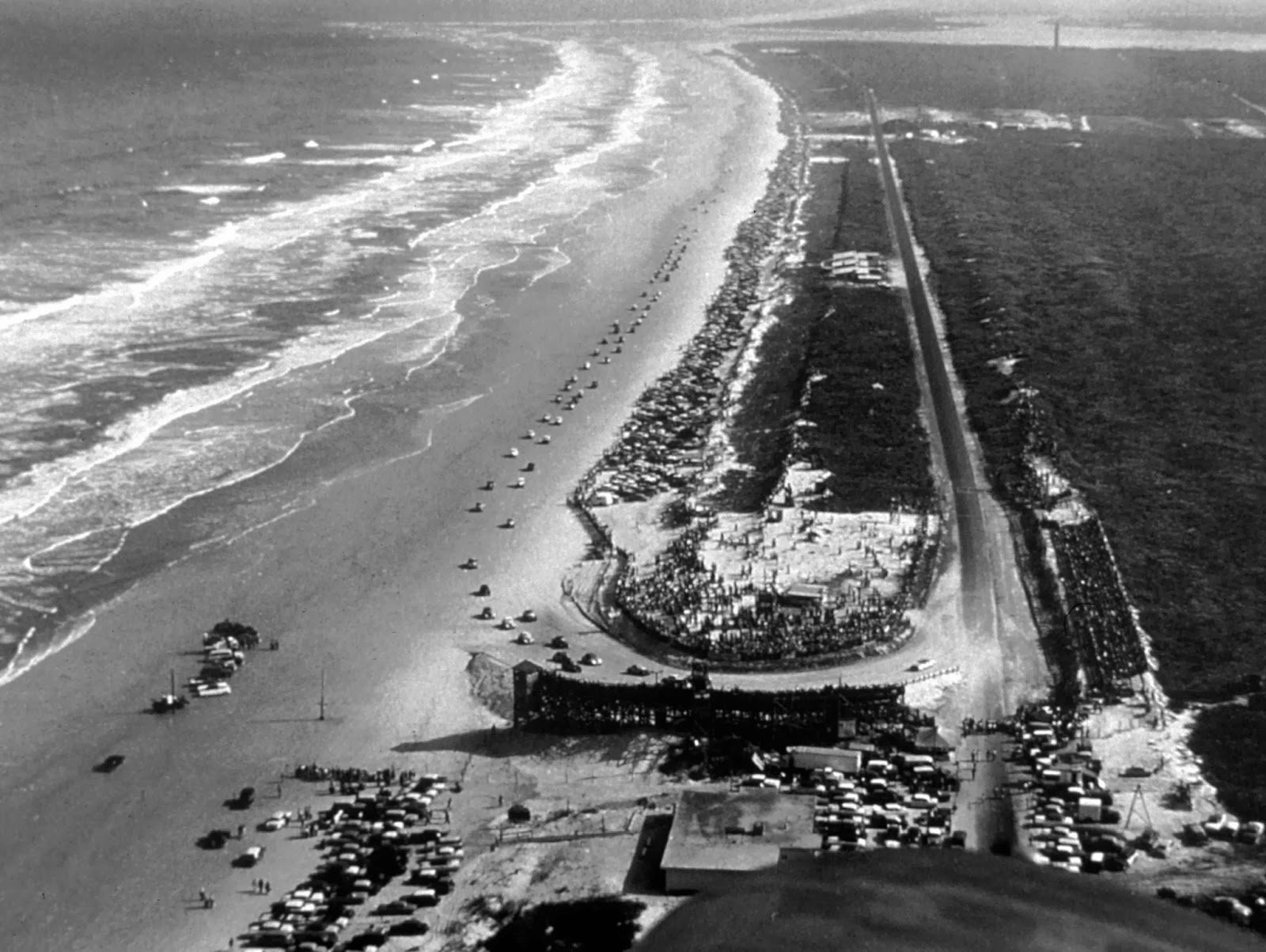

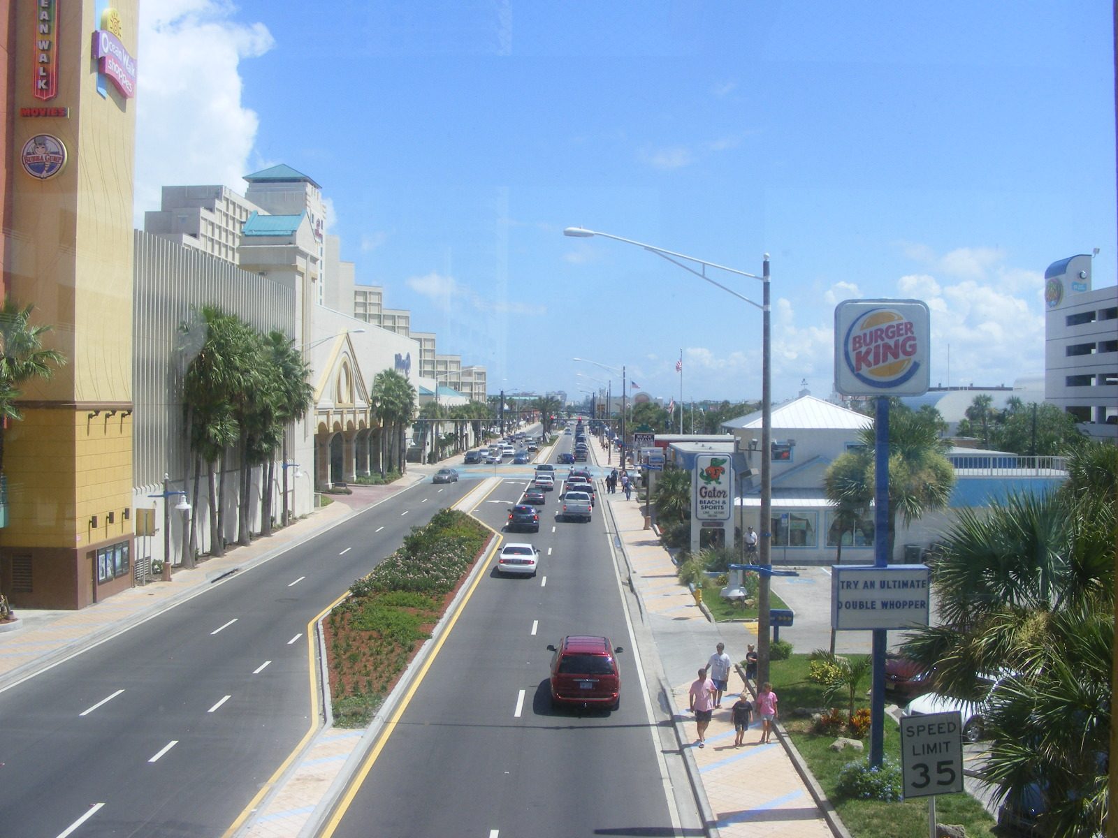
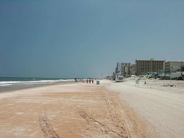
This crosses over with a recent post in classic motorsport photos but there is very little left of the original Daytona Beach & Road Course (1902-1958).
The highway section (Highway A1A) on the right today:
It rather highlights how much urban expansion has happened since the 1950s. There's almost none in the photo of the track; it almost looks like they're racing in a seaside swamp.
The beach bit is roughly the same. No land speed records since 1935, mind.
Visit the North Turn Bar. It sits on the spot of the turn in the older photo and is a landmark, marking the original northern side of the track. It is racing themed as well, so a racing fan should enjoy it.Wow, barely 60 years difference, and what a difference, I'm gonna have to make this a "must visit" place when I go to the Daytona 24 in the next few years,


It was also right next to the Port of Valencia. The whole area was an under-developed eyesore and the city had been looking for a project to fill it for years.Looking at it through Google Maps imagery, it seems that about half of the circuit were access roads leading to a parking lot.
IIt just had too many slow corners and hairpins.

Not so much abandoned, but I didn't know about the original Laguna Seca configuration. Corkscrew looks rather different as well as the lack of infield.
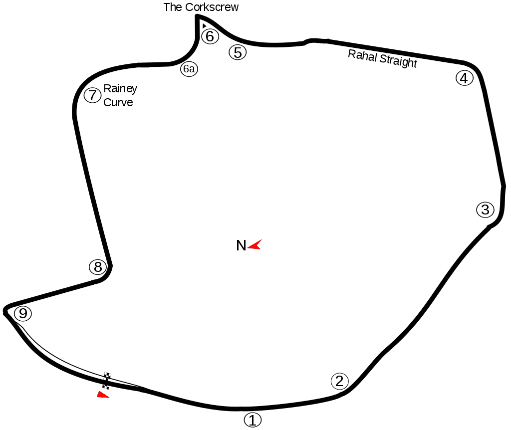
The start line on the original configuration was closer to the final corner.I'm going to recreate the original in GT6 course maker. It won't have elevation though.
Edit: Nevermind, the front straight is bent, so I can't :/
The default start is longer than either half of the front straight on LagunaThe start line on the original configuration was closer to the final corner.
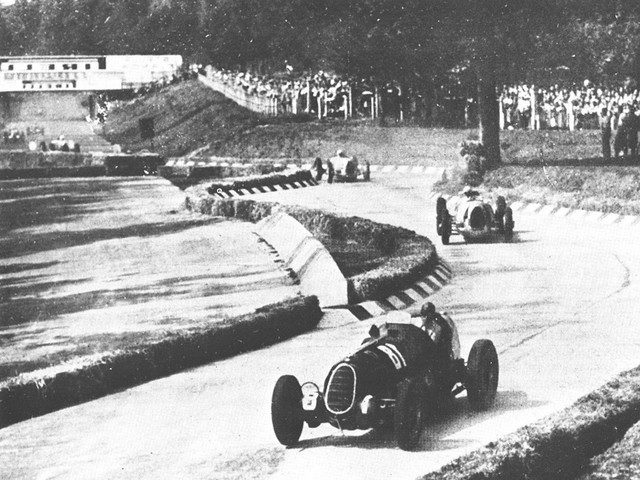
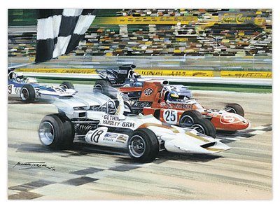
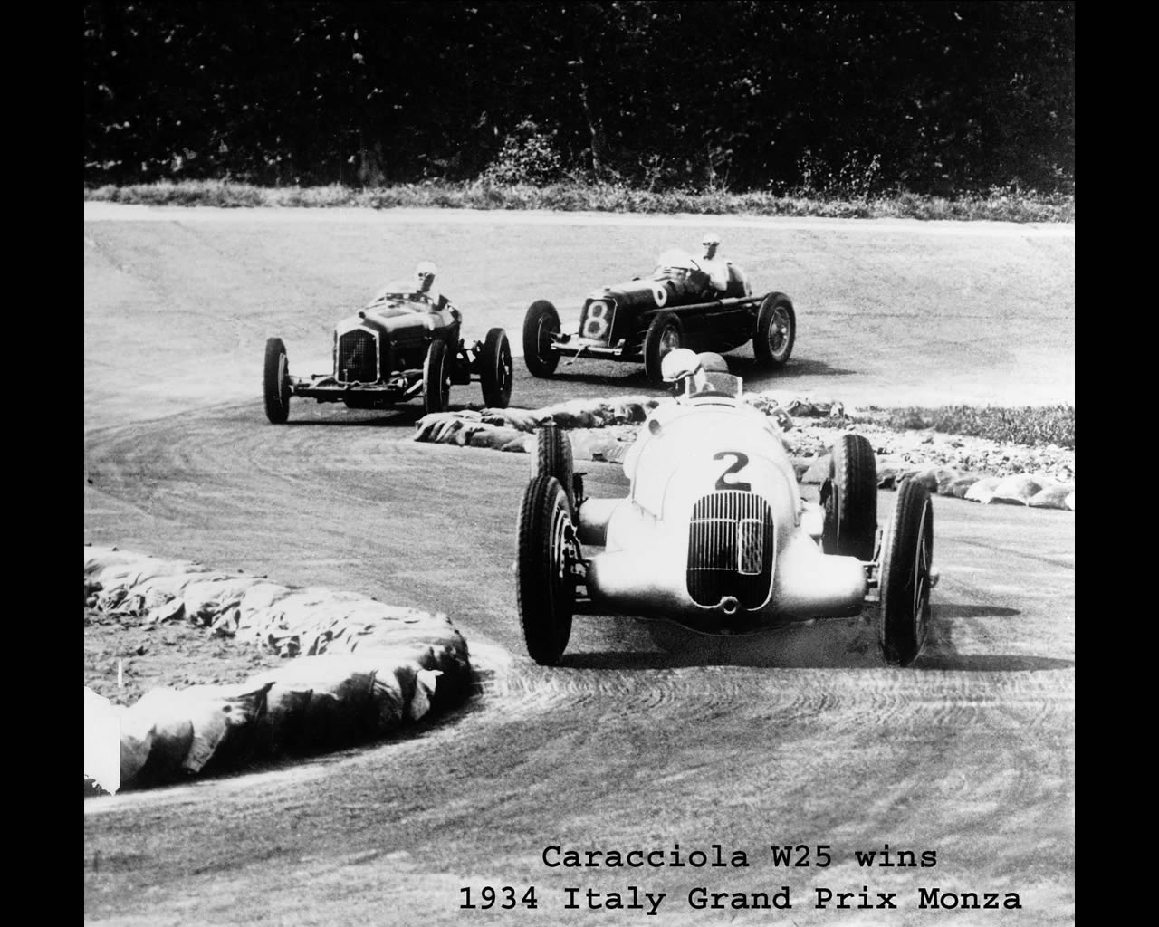
It was in 1969, Jackie Stewart winning over Jochen Rindt the closest win in Formula one.Some photos of Monza in the mid 1930s:
As you can probably guess, the reason they included those tight chicanes all over the circuit in those days was to take away some speed advantage from the German cars, so the Italian ones could have a better chance of winning. After the war the circuit returned to its former flowing glory. Until 1972 that is, when chicanes were added once more despite 1971 having one of the closest finishes in GP history.