That looks pretty awesome. It kind of reminds me of the Grand Prix street circuit in SingaporePikes Peak, High Plains Raceway, and Lookout Mountain Road would be the first ones I'd try (not in that order). Also, I threw this circuit together in a few minutes, it runs through City Park, right next to the zoo and the Museum of Nature and Science. Many childhood memories of both! Plus I think it makes a pretty nice circuit.
View attachment 234000
P.S it's 2.2 miles long w/ 15 corners
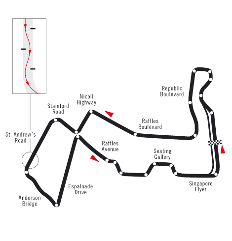
Thanks! It does look kinda similar, doesn't it? Problem is, it's going to be a lot more rough due to not being paved in quite a long time. Adds some more challenge, though. I really wanted to make a kart track through the zoo, but I don't think the city or the animals would be very happy about it...That looks pretty awesome. It kind of reminds me of the Grand Prix street circuit in Singapore
")
Oh yeah, that would be great! Only problem is there is a seemingly endless horde of unattended children and/or ignorant parents everywhere in that zoo, and I'd have to walk around them, I wonder if that would mess it up. Then again, I could always rent a golf cart.@LXM3500 you could always walk it with the app running on your phone. You'd probably get more accuracy that way too.
Man I hope we get this soon.

You mean this?:
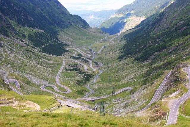
Nothing to complain about there, but it's a little like just racing from hairpin to hairpin. I think I'd prefer the flow of the Targa Florio, but a combination of the two would be great!!
Yes we do!!! The part I live in not necessarily but snowshoe would be a nice place to do a course with ultra steep hills.West Virginia has some STEEP hills!
In any case, I think you can only be faster by 10 seconds at most. Plus there are factors outside of your control such as traffic and weather that might make you late. But it's a noble cause nevertheless.I will recreate the path to my girldriend's house, to improve my racing line and get better times overall.
hoping to improve my chronic disease of being late.
A box. Wonderful.Here's my first track which I'll do in GT6:
View attachment 237188
Thanks but it isn't a box. I couldn't put the location very closer because otherwise the picture's quality wouldn't go right.A box. Wonderful.
Here's my first track which I'll do in GT6:
View attachment 237188
No. It's in Portugal, Sarilhos Pequenos, Moita.Is this the road around Osama Bin Laden's compound?
Anyways ... still no Course Editor huh? I keep checking back every 6 months or so to see if there is a reason for me to turn on my PS3. Guess not. Back to iRacing then I guess. Come on Kaz!!!
Yes. It's my home.@Harsk100 is that your yard or something?