What WILL you make with a GPS enabled or very detailed track editor?

  • Thread starter smskeeter23
  • 1,100 comments
  • 108,297 views
if we'll be able to share our personal tracks, we'd get to race in your yard everyday.
that'd bother my neighbors for sure.
Yes, I'll share my tracks so you can go race. When PD adds the ability of downloading our personal tracks, I will share my first track made so you can download it and race it.
 
I'm sorry, but GT6 came out on the 5th december 2013. It's now the 13th October 2014. Its getting more and more doubtful to the day that they would bother adding such big features to a game with only a small current audience.
 
I'm sorry, but GT6 came out on the 5th december 2013. It's now the 13th October 2014. Its getting more and more doubtful to the day that they would bother adding such big features to a game with only a small current audience.
Whoa there. That's material for a different thread. This place is for track ideas if and when the Course Maker comes to GT6. Doesn't matter here whether or not it comes at all, it's just a bunch of people brainstorming some awesome tracks.
 
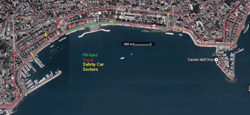
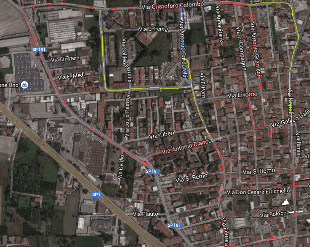
Now that i think about it, maybe i'll try to get Naples a proper city circuit, you guys have no idea what a terrific fun some streets are.
My only complain would be the lack of a pit entranc,i really can't figure out how they're supposed to do put a thing that doesn't exist on a gps data, maybe calculating the width of the road? idk
 
Maybe they will add it to the starting line. I don't think they will take the area around it into account so you can have a pit road going through people houses.
 
There's a golf course near me that has a neighborhood with nice, twisty roads. I think I could make 3 circuits from it.

Edgewood Speedway East Circuit.png
Edgewood Speedway National Circuit.png
Edgewood Speedway International Circuit.png
 
I can't wait to make a circuit round my home town, Bournemouth. I've done long and short versions so far, and I'm currently planning Bourneschleife :D Here's the short version, 2.3 miles and about 250-300ft elevation change :drool: (gmap pedometer has an elevation bug so It's hard to say exactly)

http://www.gmap-pedometer.com/?r=6162982

I have serious questions about how it will work though. I'm going to cycle mine as some streets are one-way and I'll be going the wrong way, but how will it be affected eg when I need to cross the road or if I take a corner at 90 degrees when the corner is actually a longer 45 degree turn? Or what if I have to go round a parked car, would that then be a bus stop chicane? If it's using GPS then why do we need to physically do the lap? Why couldn't we just use something like gmap pedometer to draw our route?
 
I finally had the bit I needed to draw a map.

Course-Red
Alternative Routes-Green
My favourite bits-Arrows

Sem Título.jpg


Yellow arrow: a small straight after a hard right with a huge incline and completly blinds the braking point for the next right. Looks like this:
View attachment 181002

Brown arrow: a couple of esses. A nice left and after that a hugely inclined right. Follow this road to see the esses

Blue arrow: two slow hairpins in a very steep hill. Good brakes advised. Follow this road.

Purple arrow: a set of fast esses going uphill. Extremely fun. Follow this road

Orange arrow: I call it "the wall". Very steep uphill going left and then bam!, a tight right in the top. Follow this road

In total a 5 km track where there are a lot of height changes and, I think, quite tricky to get it right.
 
First thing I would try : http://goo.gl/maps/x1ZE0

This is actually two small mountain passes joining together at both ends, one of my real test tracks :D The track is 15.4km long. Minimum altitude is around 600m (the village just next to the lowest point is at 567m), maximum altitude is 1121m : so count around 500m of elevation variation.

Lowest points : F is the lowest overall, C is the lowest on the other side of the mountain.
Highest points : B and D

From F to B, altitude rises pretty much regularly. You've done Col de Cou when you arrive at C, and begin Col des Moises, which is a bit narrower. Three corners after C, the section is relatively flat, until you enter the forest : there's a massive downhill here up to the forest's exit. Point E marks a small hill in the straight line near the houses, after that, the elevation doesn't change quickly until you come to that long 90° left hander, which again leads to a good downhill section until F.

Possible start/finish lines :
- point A-G >>> there's a small parking area right just before that should be sufficient for GT pits.
- before or after point C, depending on if you do it normal or reverse >>> you could use the continuation of the road after C to make pits, and get back on track with the small bit going between the two houses (though half of it would need to be paved).


Col de Cou video (begins at 0:48) :
Col des Moises video (sorry, bicycles much less entertaining :P ) :


I have other things like that in mind, but I'll do that later.
 
I'm honoured to bring you...
The official "Honey, i'm home alone" street circuit GP.
  • 78 laps
  • chances of heavy rain
  • Red main circuit
  • Green variation B with some of my favorite spot to drive by irl.
yellow and blue C configuration (shorter track)

25jw9y0.png
 
Here's another one : http://goo.gl/maps/GULht

That track is 8,5 km long, has a 280m elevation change, a lot of twisties in which power is not the primary thing you want. Can be fun in either direction. That's not a loop I ride as I present it IRL, because both parts belong to a longer road, or you could make much longer loops by combining them to other roads, but that would definitely not fit in even a 20x20km square, as the course maker was rumored to be for a moment :lol:

- Start/finish line on point A-E, you could put it after the corner if you were to do it in reverse.
- Point D is the lowest altitude at 520m.
From there, the road has two regular lanes (for French roads at least), and it goes uphill, but that's not brutal, until...
- Point B, altitude 600m. You could make pits in the village avoided by the turn. After that point, it is much steeper, until you arrive in the village of La Vernaz.
- Point C, center of the village, is also the highest point at 800m altitude, and the beginning of the narrowest part, with usually slippery hairpins.


Now, videos !

- From point D (4:16) to point B (7:02) :
- From point D (the video starts a bit after that) to C (3:06) :

Sadly, can't find anything between B and C, and I can't do it myself currently.

Really beginning to get hyped on the course editor feature, and hoping about the share track too.
Simply can't believe how cool would it be, to run maybe even championships, endurance races and such
 
Really beginning to get hyped on the course editor feature

So get hyped on this one : http://goo.gl/maps/Tq6YB

26,2km long, elevation change from 940m (between point A-E) to 1700m (point C). Actually, this is simply a stage from Rallye du Mont Blanc (Joux Verte), which you can easily link both end with the street linking Montriond and Morzine. This is a great piece of road, and I have a friend living right there, so I think he would map it himself :lol:

Videos :

Jean Ragnotti going insane, begins after the first series of hairpins, ends after the last series of hairpins :
Here's the complete stage, basically it just lacks the link at the bottom of the map, which adds 2 or 3 km :
 
Last edited:
So get hyped on this one : http://goo.gl/maps/Tq6YB

26,2km long, elevation change from 940m (between point A-E) to 1700m (point C). Actually, this is simply a stage from Rallye du Mont Blanc (Joux Verte), which you can easily link both end with the street linking Montriond and Morzine. This is a great piece of road, and I have a friend living right there, so I think he would map it himself :lol:

Videos :

Jean Ragnotti going insane, begins after the first series of hairpins, ends after the last series of hairpins :
Here's the complete stage, basically it just lacks the link at the bottom of the map, which adds 2 or 3 km :

As i feel like rally in gt is a little bit left out, i'm really happy to see all this people that are going to add so much content in this aspect of the game.
Just been wonderin' if it was possible to trace an existing track, i mean, if poly didnt, it was for the royalties thing.
By the same line we shouldn't be able to trace them ingame,or am i overstressing ?
 
Really beginning to get hyped on the course editor feature, and hoping about the share track too.
Simply can't believe how cool would it be, to run maybe even championships, endurance races and such

I really hope the course maker does appear "soon"...

Seems like you're from the Naples area? (I was there in September - hopped on train from sorrento) Anyway, if so, as well as the port area you could do a circuit of the old town, with those really narrow streets driving up the hill from the big White Castle whose name I've forgotten already (sorry) maybe turn right past Duomo then left and left down the hill to the square with the tall monument and then back around to the White Castle building?

Even better than that, someone has to make a point to point for the amalfi drive! Sorrento to amalfi and then up to Ravello would be awesome for rallying AND cruising (!) though the sea would probably be 2D like at Monaco lol
 
Back