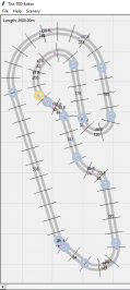
Modified Track Path Editor + Tracks/Discussion

How long are these tracks? I know that Eifel is more sensitive to track length than Andalusia, so perhaps that is the problem.
All the Eifel track with me not over 6 km as mentioned earlier in this thread. Maybe some moded TPE apk make it freeze or other reason.
 
My console always freeze when using those modded track above 2 hours. :crazy:. I think Eifel still not as stable as Andalusia. Maybe I'm wrong. :nervous:

Ps; Freeze (black screen)

Yeah my issue wasn't a black screen issue at all the car still showed on the track but the whole system locked up. Have a couple hunches but we'll see.
 
@eran0004 would it be possible to add horizontal zoom also on elevation editor, stretching graph horizontally will make adjusting easier and more precise, also visual look tells more how it will look on game. Please.

Button what switches 1:1 on x/y, keeps scale 1:1 during zoom, stretches both axis to match height and lenght as pixel/m(or what ever rate).
 
Last edited:
@eran0004 more ideas:

Copy & paste funtion (ie. Ctrl-c & ctrl-v)
* marking either just mouse scroll controllable area
- copy goes on own .ted file where it could be read with and write with paste, pastes 1:1 size
- using shift-ctrl-v and pastes to size of your current mouse scroll size area, free size
-maybe button to show ghost of clipboard on mouse scrollable area before slamming it to track (shift button version too to show scaled version also)
-button for marking longer area, ie. M-button, first press marks start point, second press end point, uses this marked area for paste if it exist and shift is pressed.

*template shapes could be stored to keyboard numeric buttons. 1 to 0 (10 slots)
- working like c&p, alt-[numkey] stores/copys area, ctrl-[numkey] write/paste, shift-ctrl-[numkey] paste to marked area, either, only [numkey] shows stored shape shift-[numkey] shows on marked area. Under mouse wheel controlled area if not marked area with M exists. Paste with shift function allows pasting udern mouse wheel controllable area or if M marked area exist it fills that area.
- storing copied data in own folder under elevation editors folder, ie. 0.ted 1.ted 2.ted etc

How hard these sounds to do?
How usable things you think these to be?
 
Last edited:
@eran0004 would it be possible to add horizontal zoom also on elevation editor, stretching graph horizontally will make adjusting easier and more precise, also visual look tells more how it will look on game. Please.

Yes. It requires a bit of work though, but it's certainly possible. And useful.

Button what switches 1:1 on x/y, keeps scale 1:1 during zoom, stretches both axis to match height and lenght as pixel/m(or what ever rate).

That's also possible. But I don't think it would be very useful, because at 1:1 your track would look more or less flat. For example, 10% is a steep slope when you go up (or down), but drawing it at 1:1 looks like this:

10percent.png

more ideas:
Copy & paste funtion (ie. Ctrl-c & ctrl-v)
* marking either just mouse scroll controllable area
- copy goes on own .ted file where it could be read with and write with paste, pastes 1:1 size
- using shift-ctrl-v and pastes to size of your current mouse scroll size area, free size
-maybe button to show ghost of clipboard on mouse scrollable area before slamming it to track (shift button version too to show scaled version also)
-button for marking longer area, ie. M-button, first press marks start point, second press end point, uses this marked area for paste if it exist and shift is pressed.

Do you mean copying the height data? You can already do that by exporting an elevation profile. It exports the entire range though, and it might be possible to add a function to select only a smaller range to export.

If you want to copy the ted file you can simply save the track with a different name. It's not possible to copy just a part of the ted file as it requires all the data to be functional.

*template shapes could be stored to keyboard numeric buttons. 1 to 0 (10 slots)
- working like c&p, alt-[numkey] stores/copys area, ctrl-[numkey] write/paste, shift-ctrl-[numkey] paste to marked area, either, only [numkey] shows stored shape shift-[numkey] shows on marked area. Under mouse wheel controlled area if not marked area with M exists. Paste with shift function allows pasting udern mouse wheel controllable area or if M marked area exist it fills that area.
- storing copied data in own folder under elevation editors folder, ie. 0.ted 1.ted 2.ted etc

That might be doable, but as elevation profiles rather than ted files.

How hard these sounds to do?
How usable things you think these to be?

Z-zooming isn't hard, but it would take some time as I would have to rewrite all the functions that refers to the z value. Usability: Very useful.

1:1 switch would be a piece of cake once z-zooming has been implemented.
Usability: As 1:1 not very, but as "lock this aspect ratio" I think it would be useful.

Copy-paste elevation profiles sounds doable, I think I know how to do it but I'm not sure if it will work until I've tested it. If it works, it wouldn't take that much time to do it.
Usability: Yes.
Sounds good!

That 1:1 thing I ment locked ratio, zooming out then (or in) will zoom both axis same amount, keeping both 1:1. Maybe we understand :)


Question about your track editor, will it eventually support .ted file import?
If yes then I have one request function for it, possibility to create elevation profile base file, just marking/clicking points on map and it will create profile where is just those clicked distances, not height, just distances. Maybe it could be produced more and add a way to input desired height also, useful option would be possibility during point marking add a reminder in to profile, few types of reminders needed or free text choice:
Down start
Flat
Up start
Top*
Bottom*
*just bonus
 
Last edited:
I'm sorry, but I don't understand what you mean. Can you explain with a bit more detail?
#start of homestraight on ground level
0.0,-155.0
#end of homestraight
600.0,-155.0
#start of first corner dive, sharp start, smooth end for progressive 200 uphill
689.0,-155.0
#bottom of dive, starting smooth progressive uphill
715.0,-160.0

Or
0.0,-155.0 #start of homestraight on ground level
600.0,-155.0 #end of homestraight
689.0,-155.0 #start of first corner dive, sharp start, smooth end for progressive 200 uphill
715.0,-160.0 #bottom of dive, starting smooth progressive uphill

Probably now I make my self more understandable.. :)

Even better if editor shows those texts when putting cursor close to that point, you know what to do, how smooth or harsh you need to smoothen current place or edit following elevation.

This will help during editing.. Now searching numbers, counting places scratching ba... Typing typos..
Look this is my first edition of markings, evolved from start to finish:
IMG_20170222_113358-1.jpg

Ps. Above Image is not accurate, and has flaws on hill/downhill lengths, on used profile most of them are corrected, even not edited to here :)
 
Last edited:
Experimenting with a kart mode in the layout creator. It uses the point-to-point start and the narrow road. Here is an example of what it can do:

https://www.gran-turismo.com/es/gt6/user/#!/friend/eran0004/course/2703262/

Because I changed a lot of things under the hood there is still some fixing needed before I can share this new version of the application. Hopefully I can have it ready before the weekend.
So expecting extra short tracks for normal cars are soon doable? Racing online, but no pitting?
 
But with GUI not.. ;)

Actually it is. If you look at my Anderson RacePark I made that with a TPE I modified. However the flexibility with the new tools shall make it much nicer.

#start of homestraight on ground level
0.0,-155.0
#end of homestraight
600.0,-155.0
#start of first corner dive, sharp start, smooth end for progressive 200 uphill
689.0,-155.0
#bottom of dive, starting smooth progressive uphill
715.0,-160.0

Or
0.0,-155.0 #start of homestraight on ground level
600.0,-155.0 #end of homestraight
689.0,-155.0 #start of first corner dive, sharp start, smooth end for progressive 200 uphill
715.0,-160.0 #bottom of dive, starting smooth progressive uphill

Probably now I make my self more understandable.. :)

Even better if editor shows those texts when putting cursor close to that point, you know what to do, how smooth or harsh you need to smoothen current place or edit following elevation.

This will help during editing.. Now searching numbers, counting places scratching ba... Typing typos..
Look this is my first edition of markings, evolved from start to finish:
View attachment 629701
Ps. Above Image is not accurate, and has flaws on hill/downhill lengths, on used profile most of them are corrected, even not edited to here :)

Agreed that would be a cool bonus feature but did you see you can launch the elevation editor from the TED editor and it will trace the brush path on the track? I use that with a 1 meter brush to place all my road and decoration elements precisely.

I've been pretty obsessed with this track path narrowing since @Mr Grumpy brought it up and so Portland I thought would be a perfect place to try it. I used a new image tracing technique with a 100 meter grid placed over the google earth images to match the ted editor grid. The image overlay program allowed me to scale the images as I zoomed in and out pretty decently but still not ideal. After trying numerous techniques though this has been the most accurate for me.

Turns 1 and 2 are 22 meters and the straight from 2 -> 3 narrows down after the apex. The turn 6 exit widens to 22 meters upon turn 7 entry and narrows back down by the exit. Turn 12 widens onto the drag strip. Really loving how the layout came out. Curbs are done and I'll be working on elevation tonight.
 
Last edited:
Agreed that would be a cool bonus feature but did you see you can launch the elevation editor from the TED editor and it will trace the brush path on the track? I use that with a 1 meter brush to place all my road and decoration elements precisely.

Haven't play enough with TED editor yet, saw at it's showing precise points, but learning more.

I used a new image tracing technique with a 100 meter grid placed over the google earth images to match the ted editor grid. The image overlay program allowed me to scale the images as I zoomed in and out pretty decently but still not ideal. After trying numerous techniques though this has been the most accurate for me.
Mismatch on size is one really big thing with background track images, maybe installing PS back to laptop, or just Gimping.. That will need some good solution.. Google maps exporting tool or Here maps..gotta do small googling.. :)
 
Agreed that would be a cool bonus feature but did you see you can launch the elevation editor from the TED editor and it will trace the brush path on the track? I use that with a 1 meter brush to place all my road and decoration elements precisely.
Cheeked TED editor.. I'll bet at something is wrong on my version.. This is that v0.2 and there is no menu or anything to start elevation editor inside it, there is folders on editors directory containing elevation editor, but no way to start it.. Something isn't right on installation, it looks like this:
test editor.png

Installed newer one, pressed every key and now I'm starting to get in to it :)
Uff.. Need to install second display to my laptop, banking editor blocks view on one screen.. :)

Okey, now life is much easier, even visual look is way better now when using 22" as main screen and laptop ~14-15" as reference screen.. Some updates to track on way :)

This give lot and lot more to tweak/tune on my Zandvoort.. Currently my Zandvoort is..well.. Preview version of upcoming final :D:lol:

I just wish at gui for decorations will be available on some day, then scaling to 1:1 track lenght would be usable without hexagonal dreams four days..
 
Last edited:
Interesting. If you leave the checkpoints empty, the game creates one for you at half the track distance. I'm testing a really short track (<500 m) and it was too short for my algorithm to create any checkpoint, so I uploaded it to the game and there it had a checkpoint at half the distance.

Perhaps all tracks need at least one checkpoint in order to work?
Can you place checkpoint where you want, thinking if next track would be 1:1 precise size and everything 1:1..
...hmm code checkpoint or time checkpoint? (I just woke)
 
Can you place checkpoint where you want, thinking if next track would be 1:1 precise size and everything 1:1..
...hmm code checkpoint or time checkpoint? (I just woke)

Timing checkpoint. And yes, in the TED file the checkpoints is a list of distance values, so by changing those you can place them anywhere you want.
 
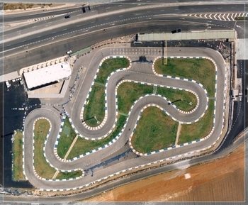
Another kart track, modelled after La Manga Go Karting Circuit

95687p028_1_001.jpg


https://www.gran-turismo.com/es/gt6/user/#!/friend/eran0004/course/2703883/

There are some issues with road overlap as they are spaced slightly too close. But the track is fully functional and at the correct scale (based on Google Maps measurements). It's also a lot of fun with the karts :)

Yes road overlap is the enemy with these, I had to work very diligently with Anderson to get it right. Did you try playing with the road a and ab values at all? I had a hunch those moght play into that.

I feel like the curbs at Eifel are so bad for karting. One of these days I'm gonna manually switch Anderson over to Andalusia.

A and B might just be for internal use in the TPE app. But I can try some changes and see what happens.

A and B probably corresponds to the track side A and track side B of the decorations, and if so it would be the width of each of these decoration slots. But the variable might just be there for use in the TPE app (for displaying the border around the track).
Even still if thats the case you can use it to display border around the track in the editor to help avoid overlaps?
 
Just learned that you can export canvas content as a postscript file and produce a high quality track map with a single button press :eek:

file_name.png


Just need to make some changes to the grid script, because right now it captures the full length and width of the map, and that's a little overkill...

Edit: Look at the resolution :drool:

closeup.png
 
Last edited:
Course Layout 1.3.8

Changes:
  • Switch between short straight and regular straight by checking/unchecking the short straight checkbutton. Short straight uses the point-to-point start (single road segment) and also changes the road elements from normal width to narrow width.

  • Position of start line is indicated on the map. The direction arrow has also been moved to the position of the start line.

  • The corner count algorithm has changed and some of the controls can be adjusted by the user. Corner treshold adjusts the limit for how sharp a corner needs to be relative to its radius before it's counted as a corner. Corner merge distance sets the maximum distance between corners for them to be counted as a single corner (corners with no straight between them are always counted as a single corner).

  • The bank angle algorithm has changed. Straights that are less than 30 meters long have their bank angle determined by their neighbouring corners.

  • You can generate a postscript image of the visible canvas. This is a vector file that can be used to create a high quality image of your track. To view the image you need a program that can read postscript files. Adobe Illustrator can do that, but I believe that there are also some free programs you can download. You can also convert postscript to jpg here: http://image.online-convert.com/convert-to-jpg

    (Just remember to set the DPI fairly high (300 at least) when you convert it, as the picture will be low resolution at the default settings.)

    Generating a postscript image is currently linked to the 'debug' command, press <b> (this will also print some data to the console). The image is saved in your current directory as a rather generic "file_name.ps". Note that when you generate a postscript image it will overwrite any current files with the same name, so if you want to keep an old postscript file you need to move it and/or rename it before you generate a new.

  • The animation (<p>) has been given a frame rate which it will try to keep to the best of its ability. You can also add up to 6 cars on the track by pressing <spacebar> while in animation mode.

  • Change the position of the start by pressing <left> (move back) or <right> (move forward). The start moves to the previous / next polygon point.
I think that's about it...

Here is an example of a postscript image (converted to jpg) generated from version 1.3.8. This is a kart track, using the short straight. Track length is about 830 meters.

file_name (2).jpg
 

Attachments

  • Course Layout 1.3.8.zip
    22.1 KB · Views: 22
The corner count algorithm has changed and some of the controls can be adjusted by the user. Corner threshold adjusts the limit for how sharp a corner needs to be relative to its radius before it's counted as a corner. Corner merge distance sets the maximum distance between corners for them to be counted as a single corner (corners with no straight between them are always counted as a single corner).

Can you use this corner threshold and radius length as a base for an option to auto generate curbs? :cool:

Also, those graphics look phenomenal.
 
Took me a bit to get my banking transitions to lineup with my height points but maths ftw. Gateway is coming tonight, just need to finish up some external decorations. Banks, roads, elevation, roughness, curbs, stands, and some extra sand traps for safety reasons are all complete :-D

EDIT: Long night at a wedding will fix up the deco tonight and post it up for you all.

EDIT 2: I refuse to double post but Gateway has finally been completed. https://www.gtplanet.net/forum/resources/gateway-motorsports-park-road-course.5755/
 

Attachments

  • GatewayTedPreview.png
    GatewayTedPreview.png
    13.6 KB · Views: 26
  • gateway100meter.png
    gateway100meter.png
    272.7 KB · Views: 22
Last edited:

Soon I can start digging sandpits and other decoration.. Few adjustments left on bankings.. Don't try track is only suggestion, addictive stuff :) I prefer people to replicate tracks which aren't good to drive, they might be ready much much sooner :)
 
Back